
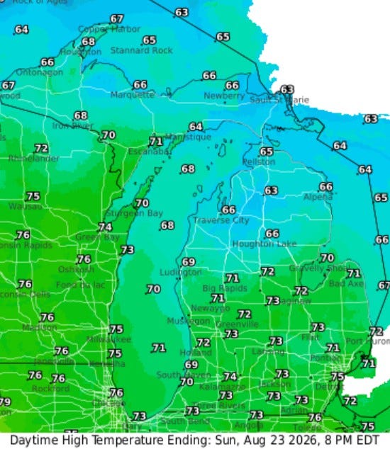
Afternoon temperatures will be mainly in the low 70s today - upper 60s at Lake Michigan. The wind will be cool and brisk, from the northwest at 10-20 mph.
BTW, we’ve just had 3 consecutive days with a high temperature of 80° in Grand Rapids, followed by 3 consecutive days with a high temperature of 79°.
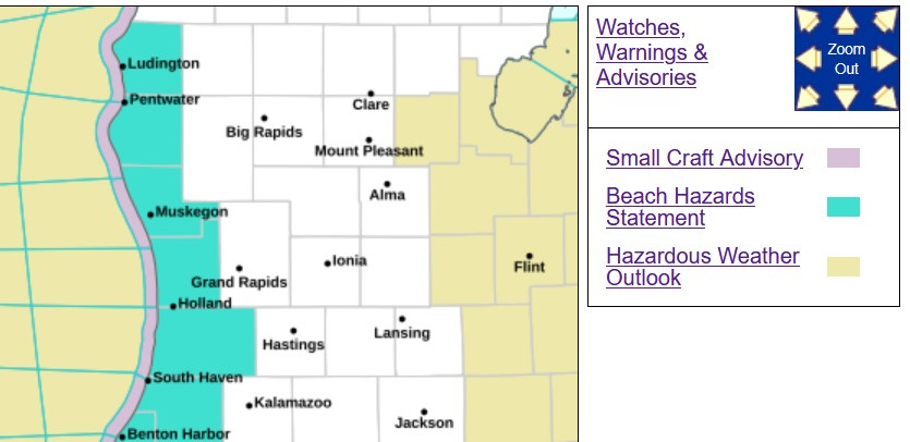
There is a Beach Hazards Statement and Small Craft Advisories in effect for today, for winds of 15-25 knots and waves up to 3-6 feet. The Beach Hazards Statement is also in effect for northwest Indiana and Cook County in Illinois (Chicago).
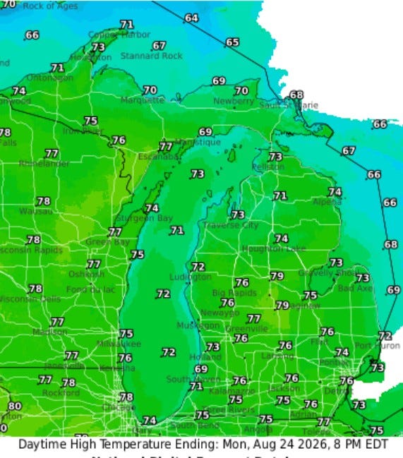
High temperatures will be a touch warmer on Monday, with afternoon readings in inland areas up to the mid 70s. Winds may continue to be a little brisk on Monday, west to northwest at 10-20 mph.
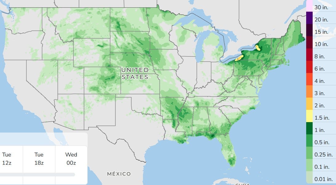
Here’s 3-day total rainfall. No big storm systems in the U.S., just areas of showers and storms, most not severe. Today, the chance of rain isn’t zero, but it’s only about 20%, so plan on a dry day, especially if you are near the lake. Monday and Tuesday look dry. So with three dry days in a row for most of us, the map above shows no measurable rain for Grand Rapids.
There was a waterspout on Stony Lake in Oceana Co. Saturday evening:
0716 PM     WATERSPOUT       2 W STONY LAKE          43.56N 86.53W
08/22/2026                   LMZ848             MI   TRAINED SPOTTER

Here            VIDEO CONFIRMATION.
Here’s storm total rainfall from Saturday:
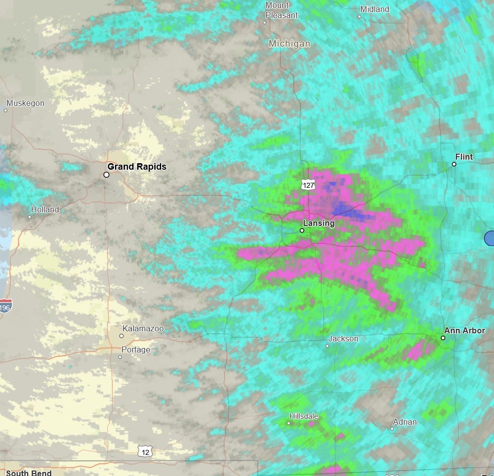
Here’s storm total rainfall for Saturday. I had just a trace, one little ol’ sprinkle, but heavy rain fell in the Lansing area. The dark blue on the map above is over 2”.
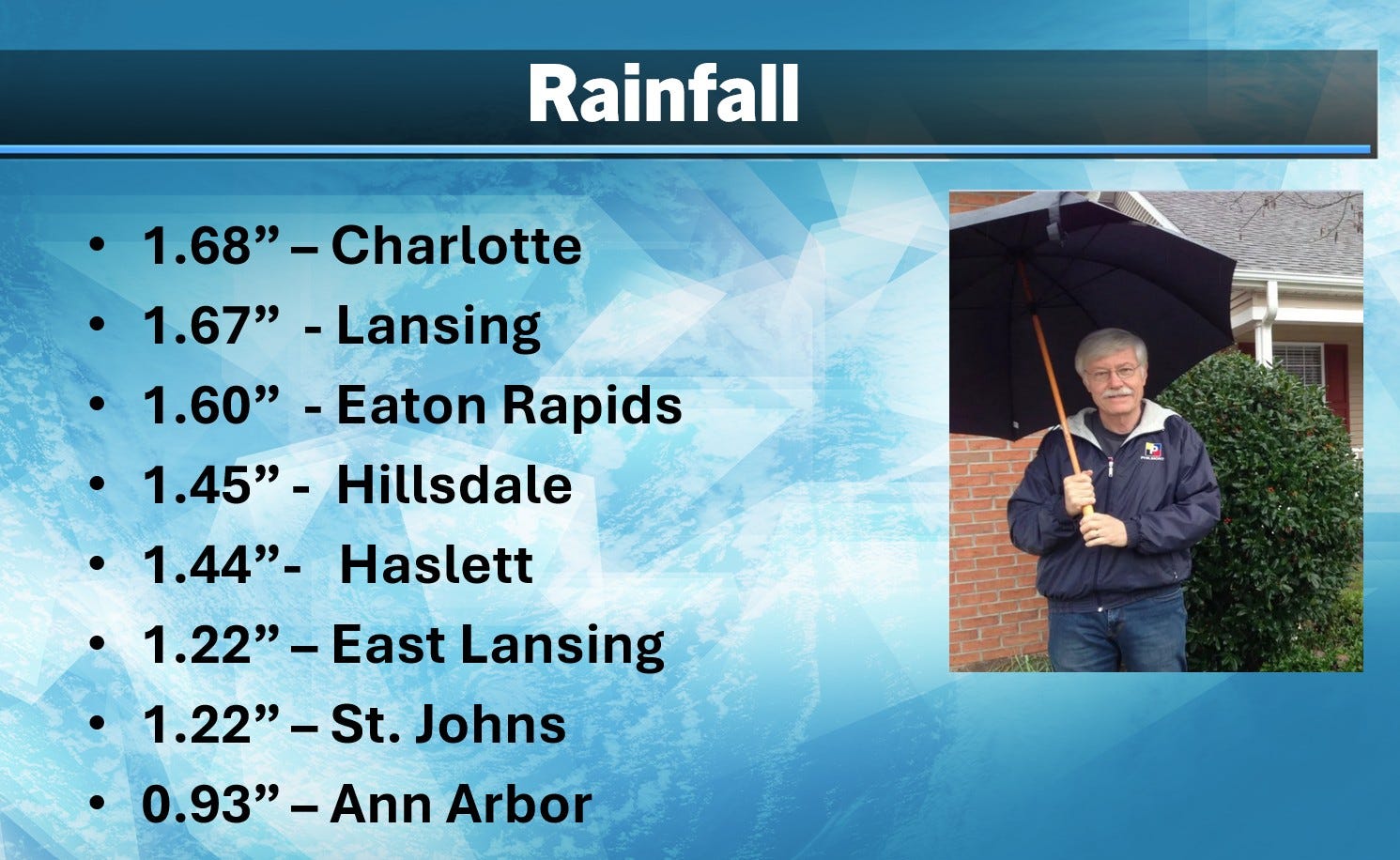
Here’s some more rainfall totals from Saturday.
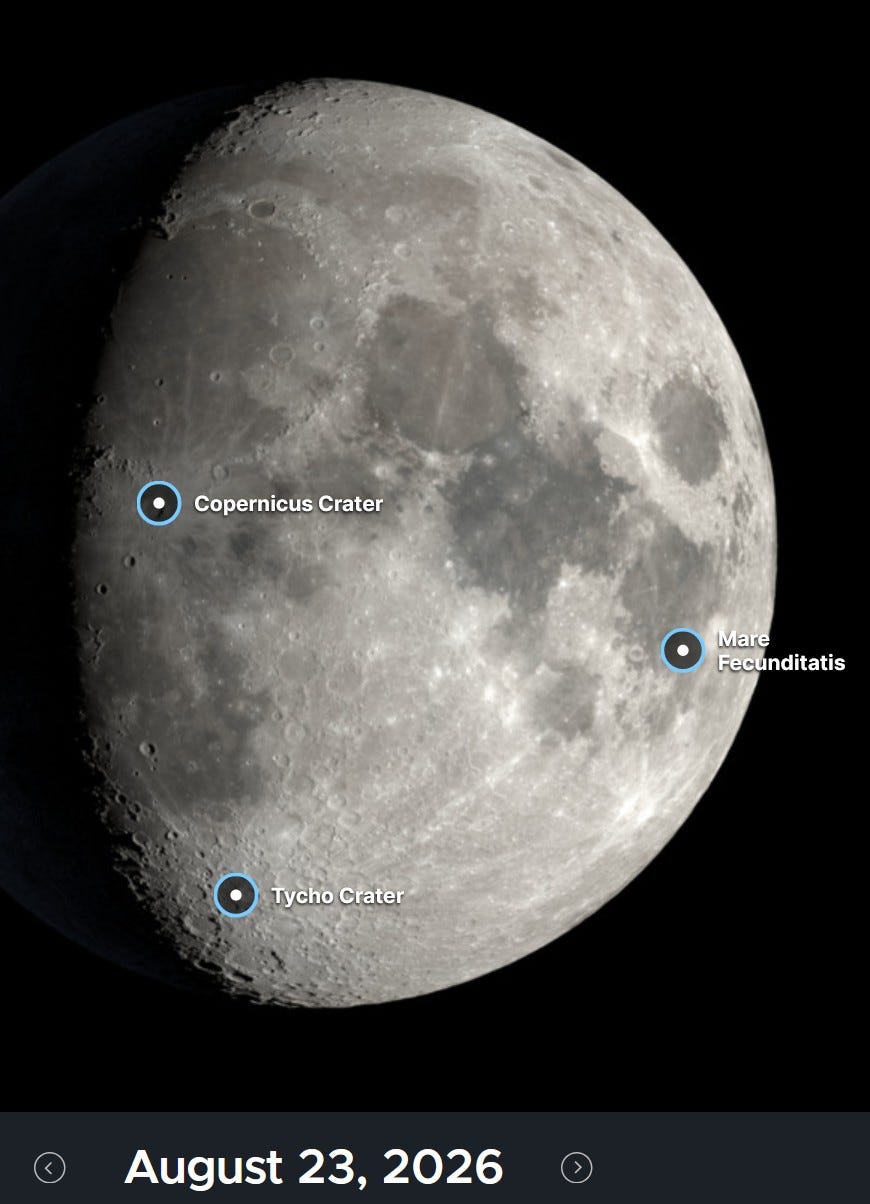
Here’s what the moon will look like this evening…about 3/4 full.
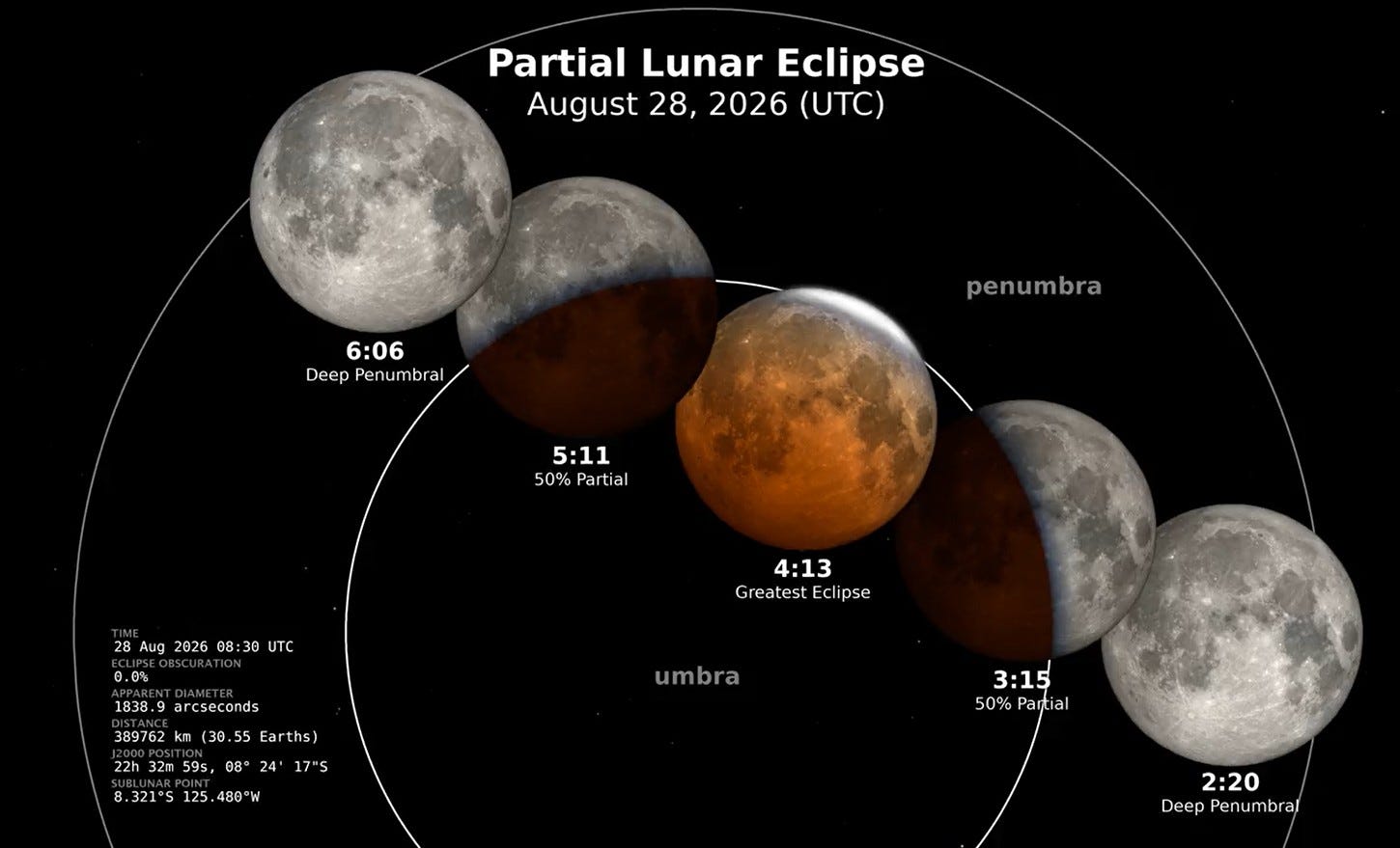
Hey, we’ve got a lunar eclipse coming up early Fridary morning…it’s not a total eclipse, but it’s 96% and that’s pretty good…visible throughout the Western Hemisphere.
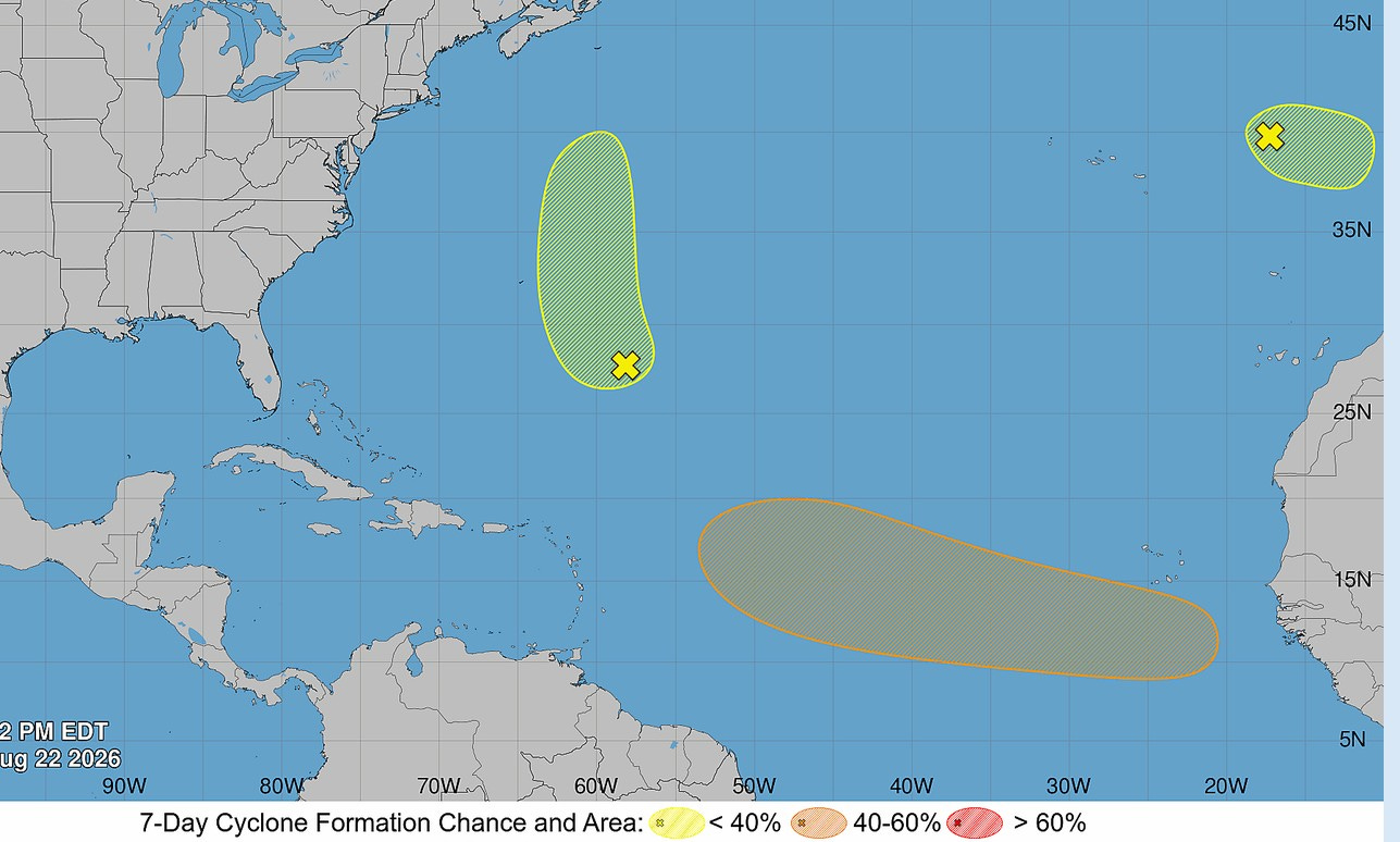
Tropical update: The odds of a tropical depression/storm forming off Africa are up to about 50/50 (orange color). If it does form it’ll likely move west, then northwest. Certainly something to watch, but it would be about a week away from reaching the U.S.
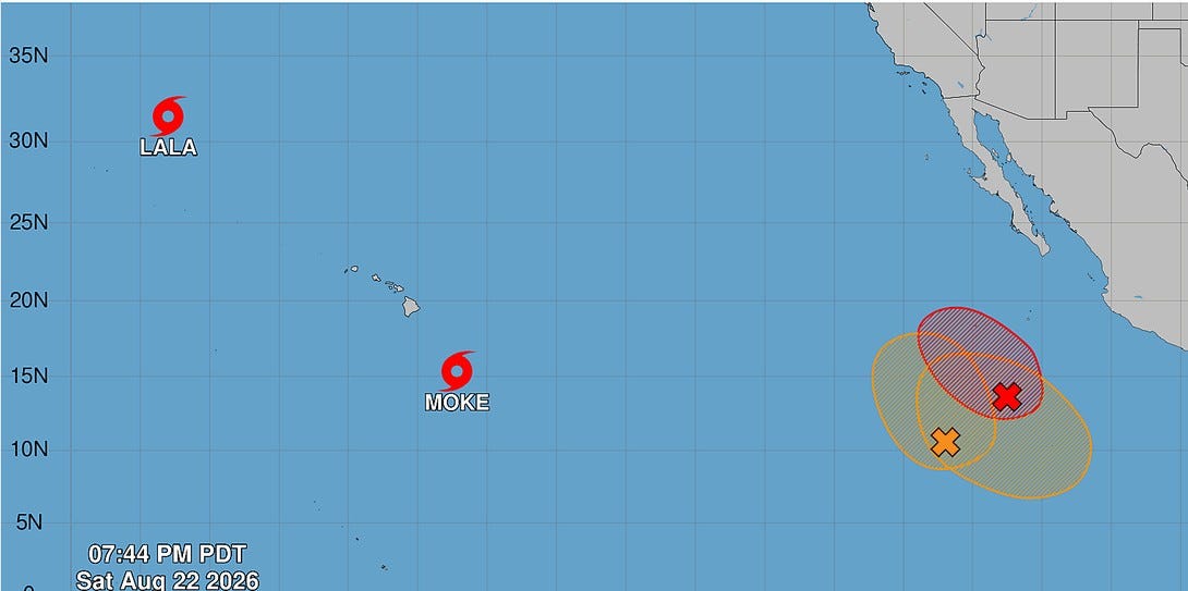
Here’s the eastern Pacific. Lala has been downgraded from a hurricane to a tropical storm. It will continue to weaken as it moves north into cooler water. Moke going to pass farther south of Hawaii than Lala. It’s also supposed to remain a tropical storm. So, while Hawaii should get a day or two with brisk winds and showers, it won’t be as significant as Lala. BTW, Lala hit Hawaii lasts weekend and a week later, they still have 6,633 customers without power on the Big Island.
Another tropical storm will likely form well west of Mexico. We’ll wait until it forms to determine a path, but it looks like it’ll miss land areas.
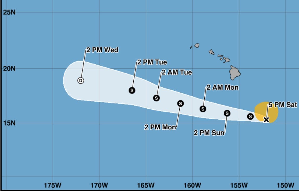
Here’s the path of Moke…again moving pretty much south of the Islands.
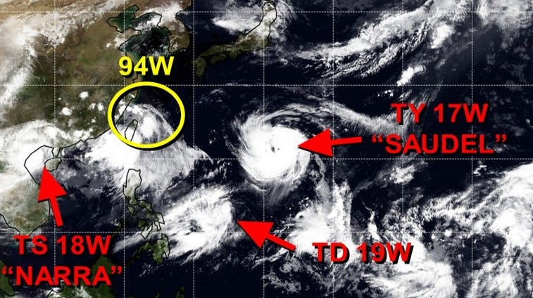
The western Pacific also remains rather active. The storm to watch here is Saudel, which is moving west-northwest.
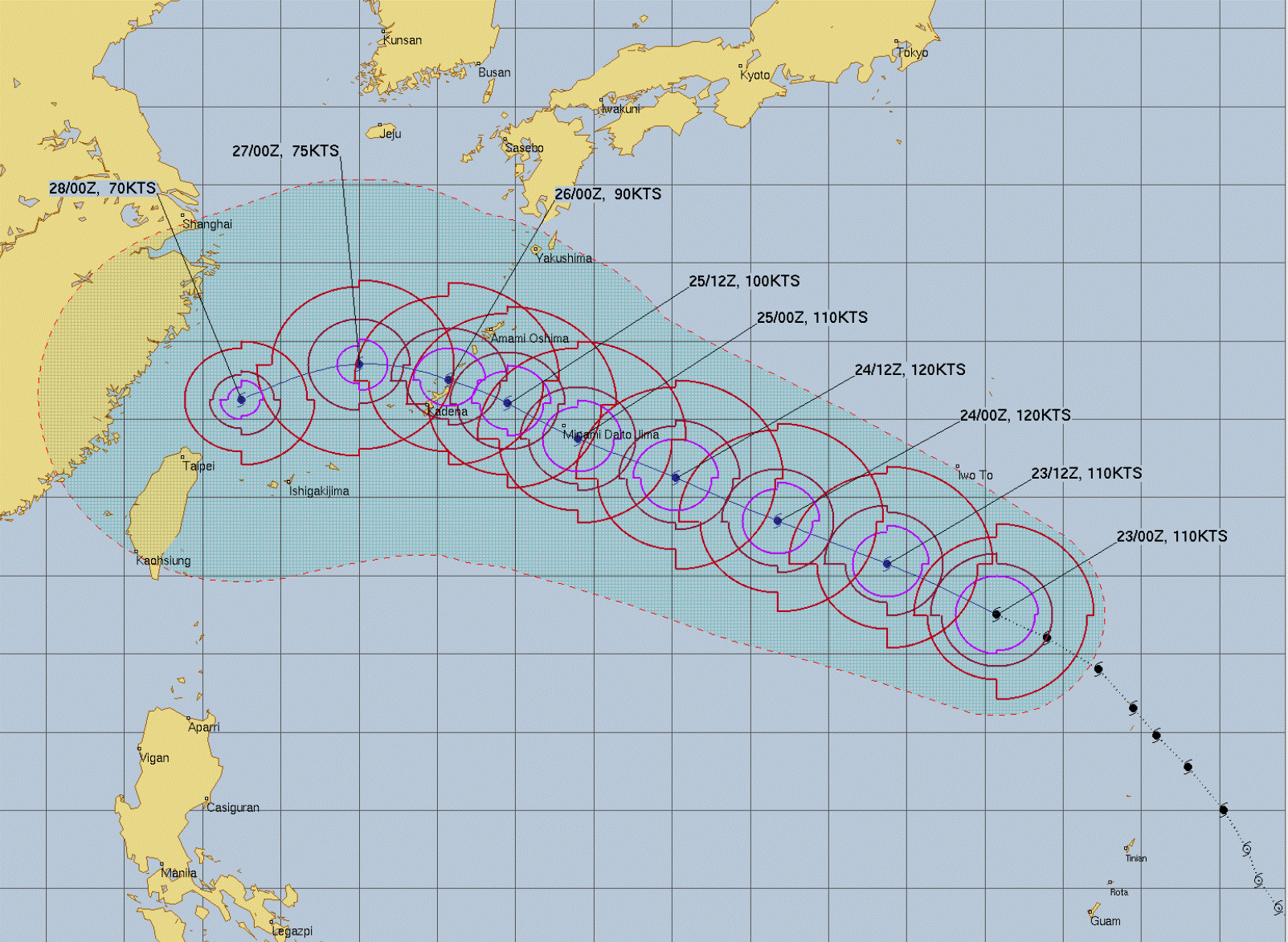
The latest models show the storm turning more west southwest and coming closer to Taiwan, then going into mainly China. It should be a formidable hurricane for the next few days, then may weaken a bit as it approaches land later this week.
Also: Multiple aircraft moved by +75 mph winds in Italy.
Have a wonderful day!
Oh my gosh loving this weather!