
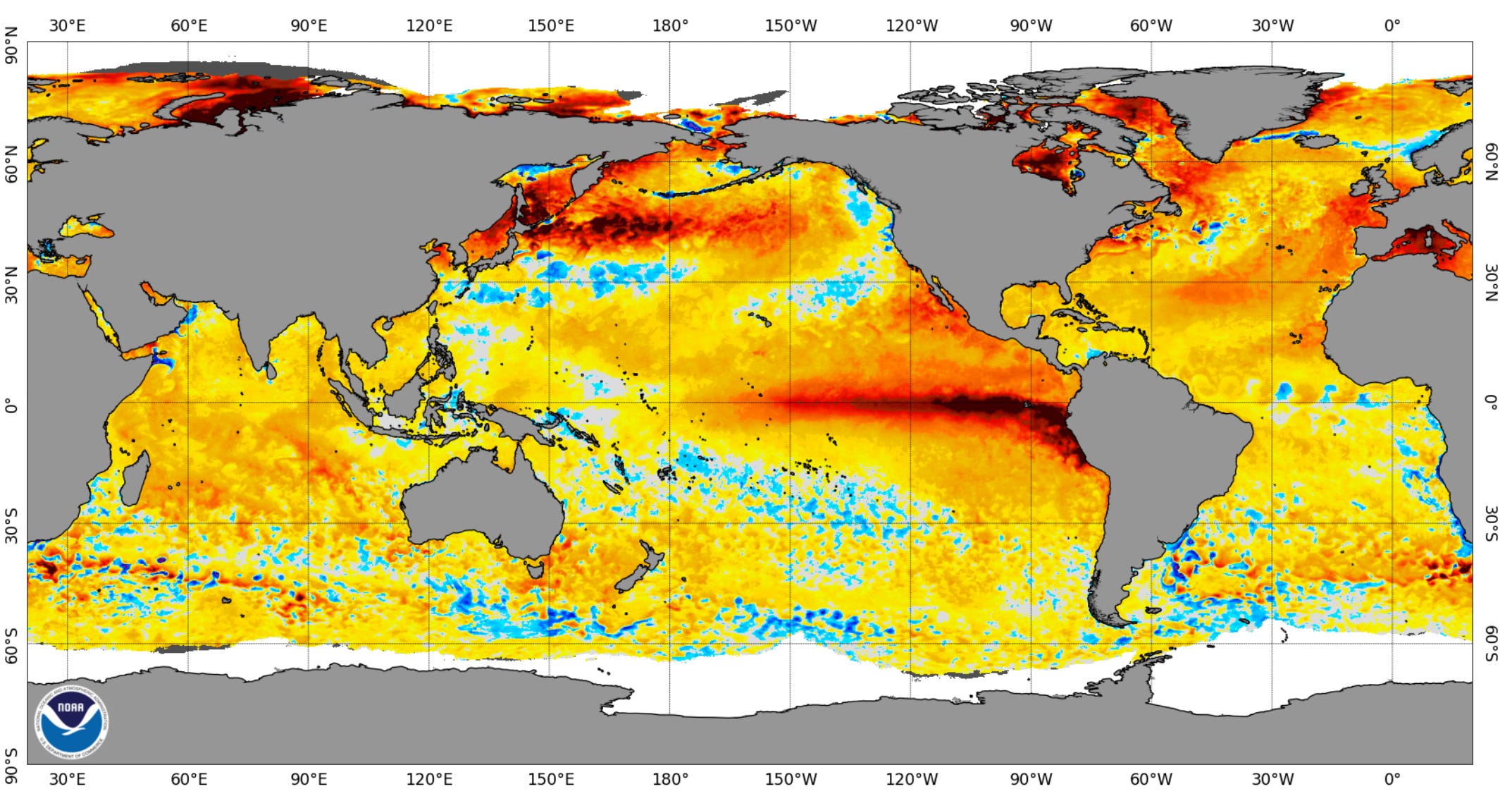
Here’s a look at global sea surface temperature anomaly. That means this map shows where surface water temperatures are warmer than average (yellow, orange, red and maroon) and cooler than average (shades of blue).
You can sure see the El Nino…the warmer than average water temeratures along the Equator west of South America. The water warms up when wind speeds are lower and the surface water can sit in the tropical sun and warm up. When we have La Nina, the wind is stronger and stirs up colder warmer from below the surface.
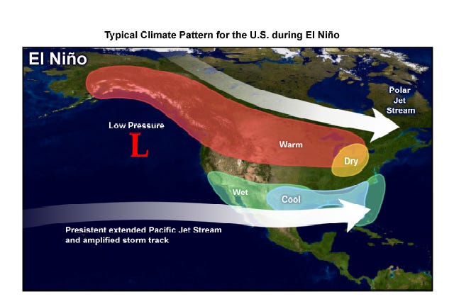
More often than not, a strong El Nino produces this kind of winter pattern…with cool, cloudier and wetter weather across the South. It also produces an occasional winter tornado over Florida. The northern U.S. is warmer than average with less snow than average…it’s warmer, so there is less lake-effect snow and more storms bringing rain or a mix instead of snow.
A classic El Nino occurred during the winter of 1982-83. That winter we had five days in December that were in the 60s in Grand Rapids, including a 65-degree afternoon on Christmas Day. We had only 36” of snowfall that winter in Grand Rapids and the snowiest day of the winter was the first day of spring, March 21. There were a lot of cloudy, dull days with high temperatures in the mid 30s to low 40s.
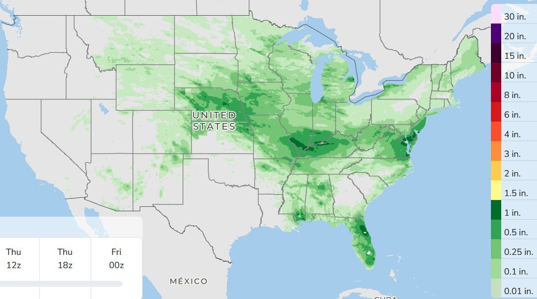
Here’s 3-day total forecast rainfall. They continue to get thunderstorms and local flooding from Missouri to Virginia and it continues to be dry over much of the West.
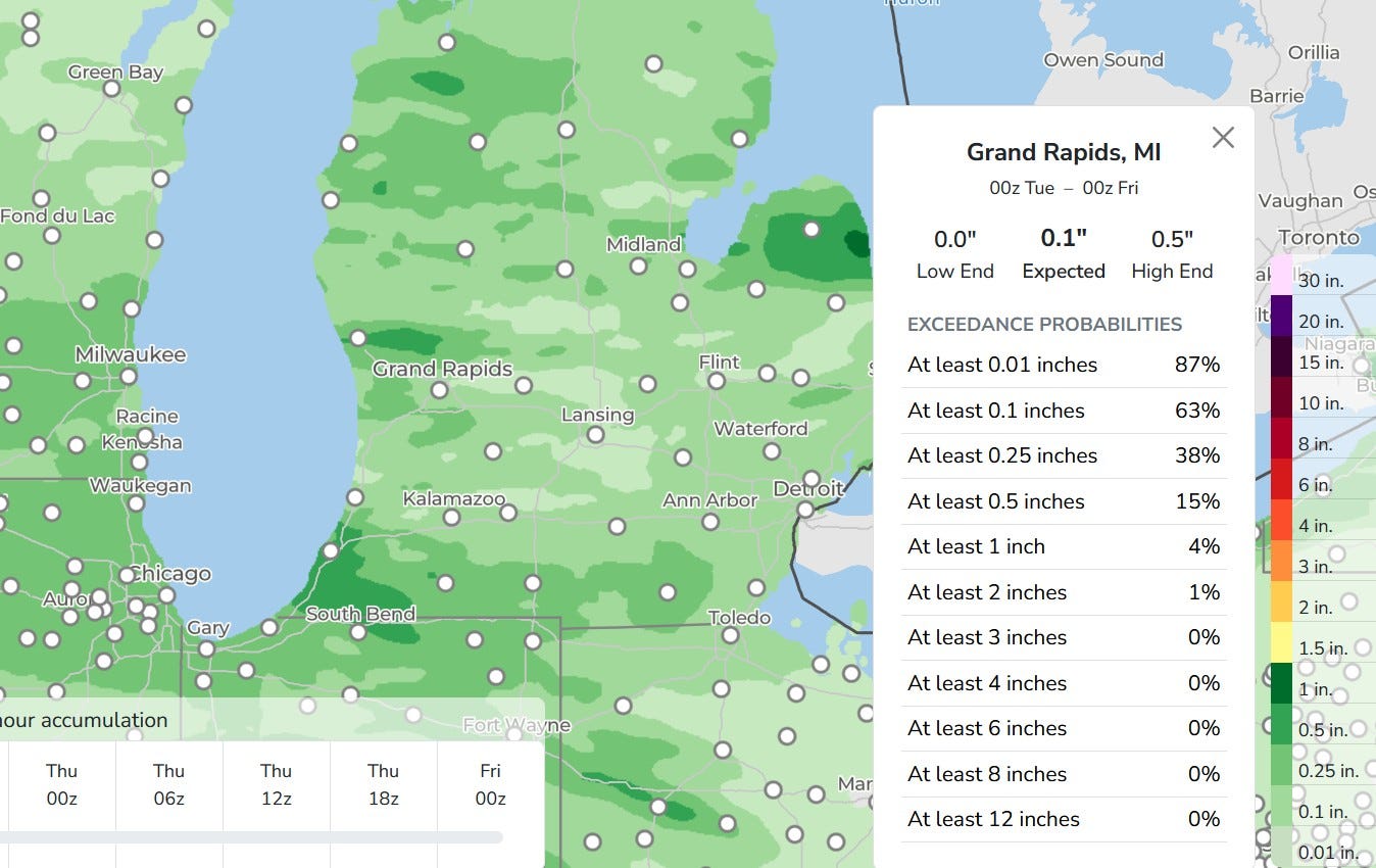
Rainfall in Michigan should be spotty. Our rain could come anytime from mid/late afternoon Tuesday into early Wednesday. This model has some areas getting 1/10th inch to over 1/2 inch and again that’ll be mainly Tuesday night.
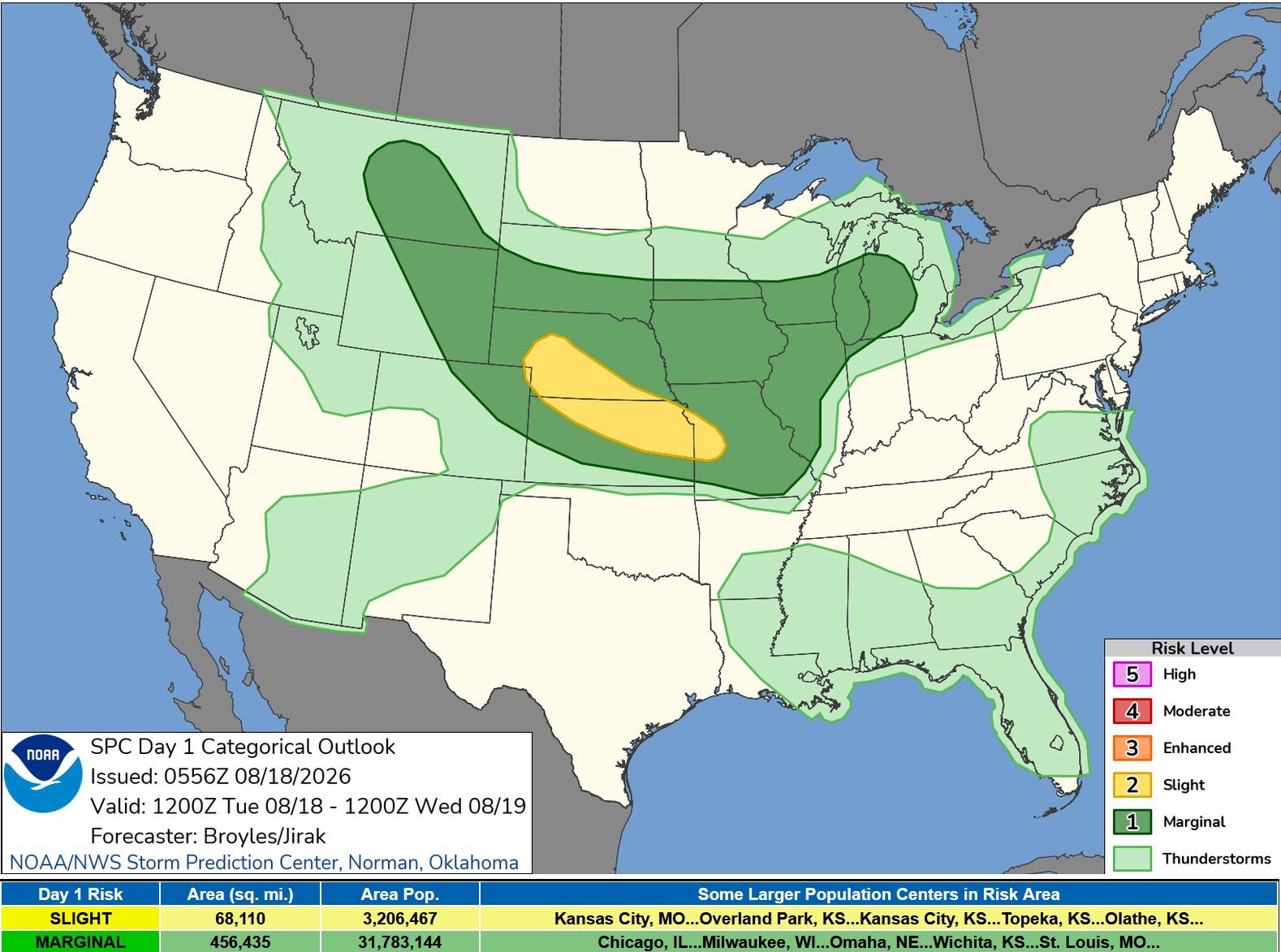
West Michigan has been added to the (dark green) level 1 Marginal Risk Area for later today and tonight. SPC says: “Isolated to scattered thunderstorms appear likely to form along and south of the front in the late afternoon and early evening…will be favorable for isolated severe storms capable of severe wet downbursts (of strong wind).”
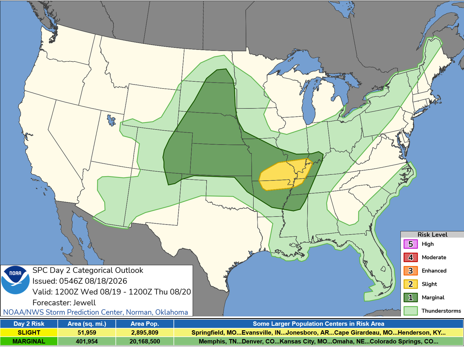
Here’s the Severe Weather Outlook Map for Wednesday PM/night. It does not include West Michigan.
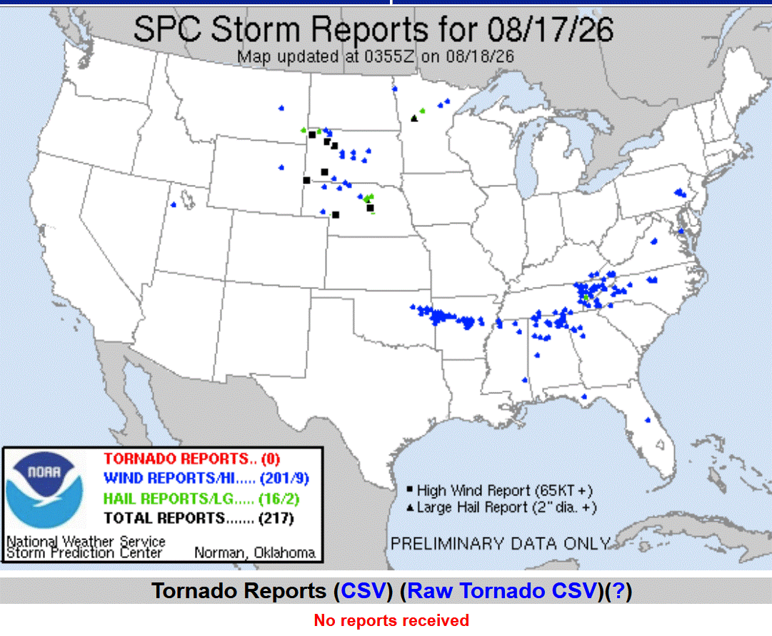
Here’s storm reports from Monday. Once again…no tornadoes in the U.S., but a good number of severe wind reports. The strongest storm winds were in S. Dakota, where Ardmore had a gust to 97 mph and Rocky Ford a gust to 92 mph.
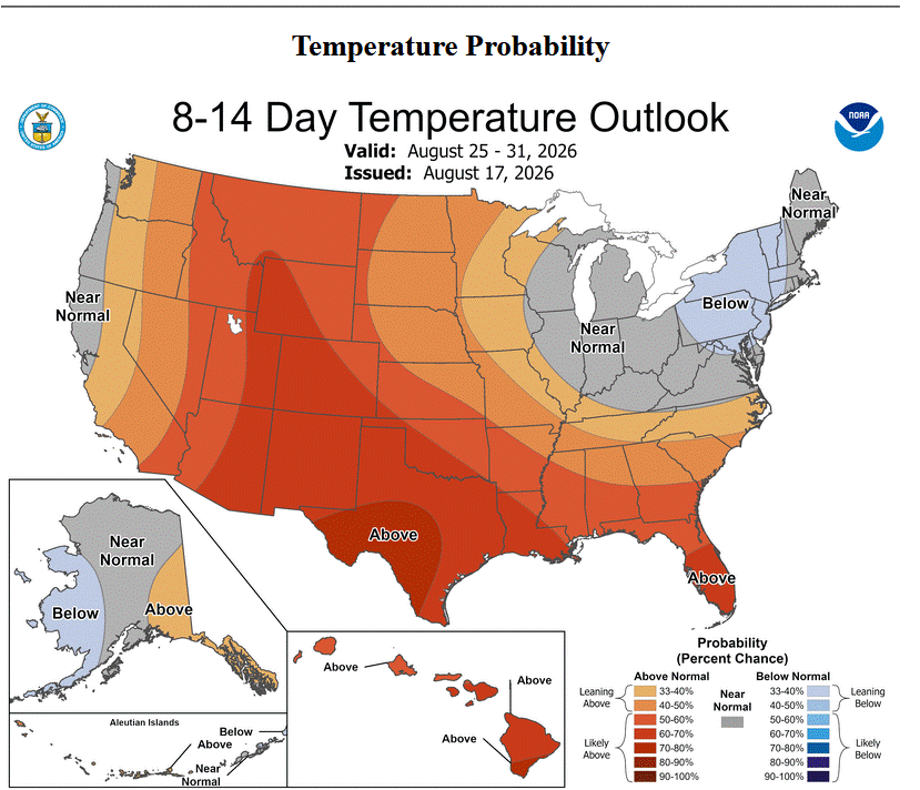
Here’s the 8-14 Day Outlook from the Climate Prediction Center for the last week of August. They are expecting near average temperatures in the western Great Lakes. That would give us average high temperatures in the upper 70s.
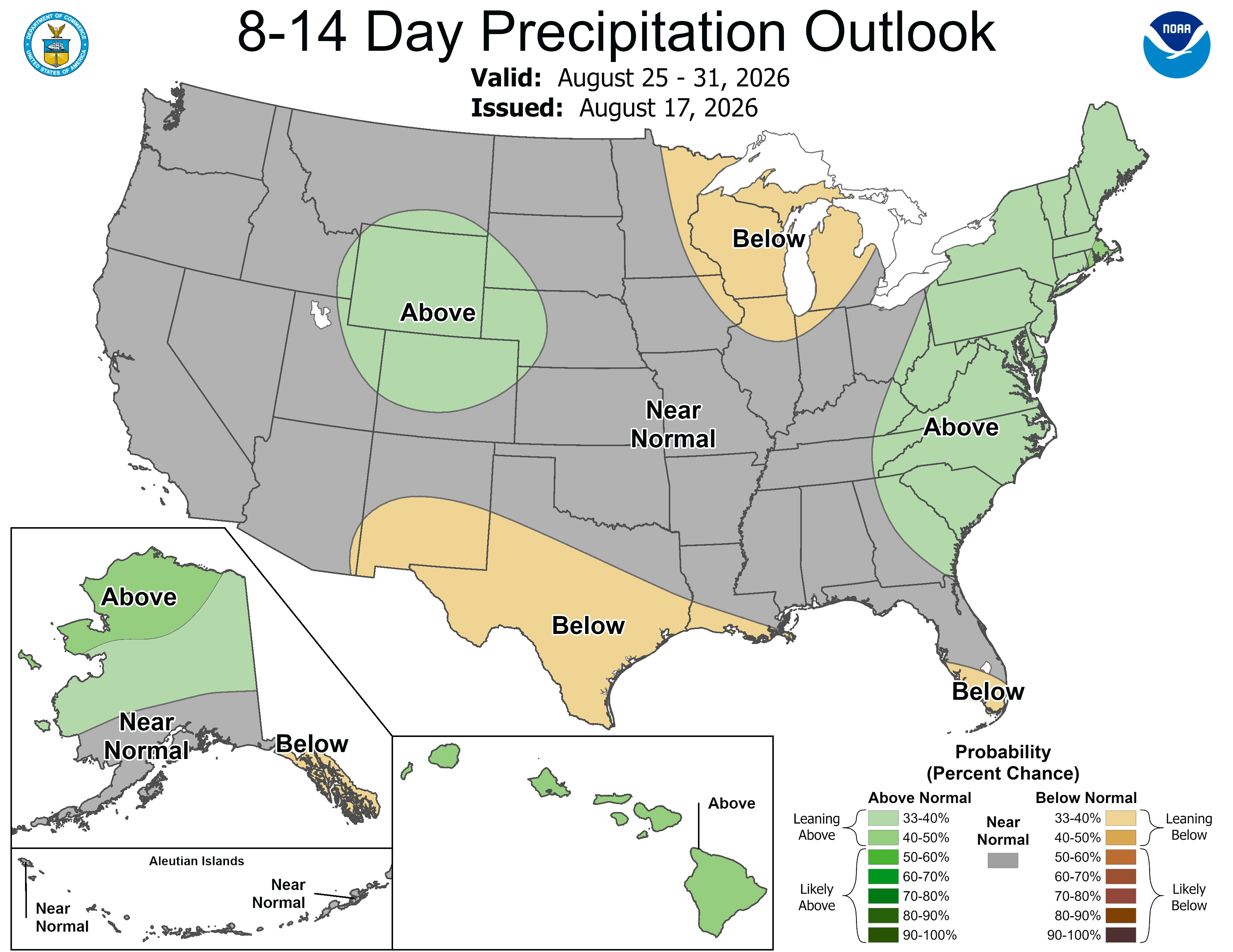
Rainfall is expected to be below average in Michigan.
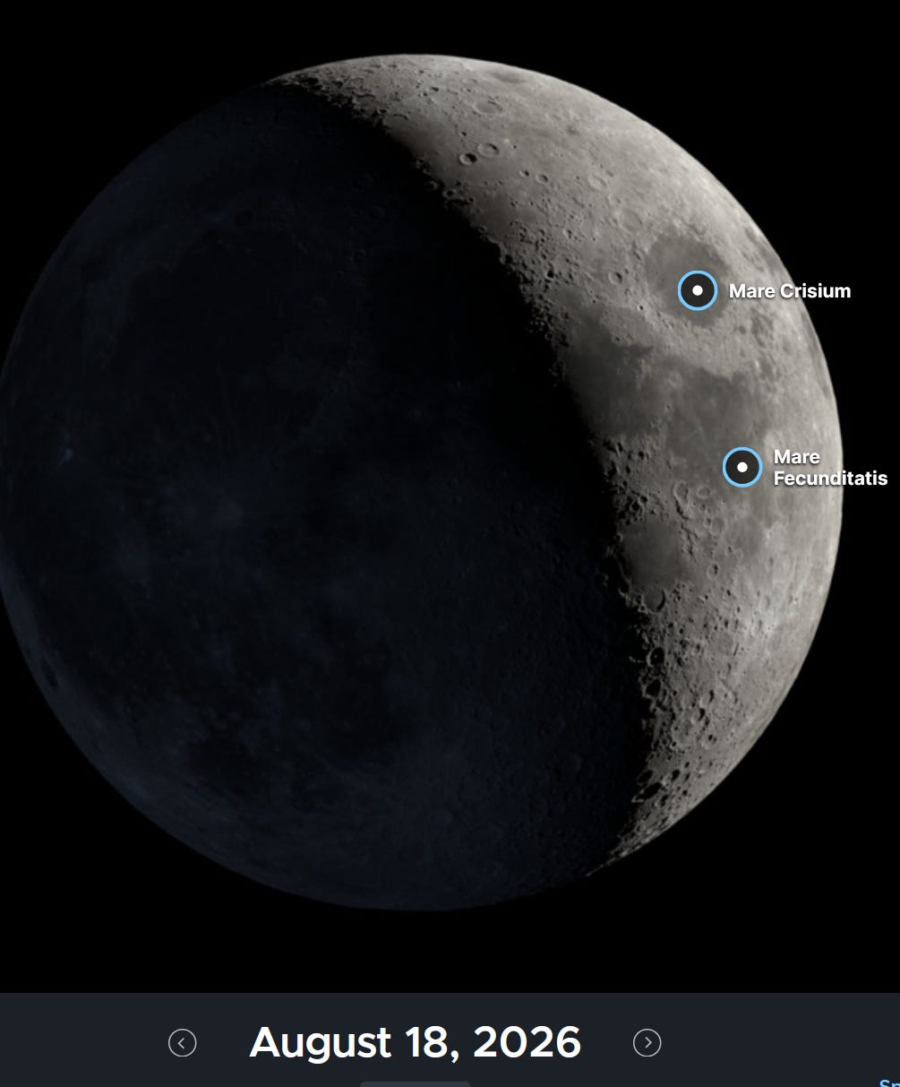
A nice, crescent moon will be visible this evening (if the clouds and showers don’t get here first). It’s about 26% full. Also look for the bright planet to west in the evening. Outside of the sun and moon, it’s the brightest thing in the sky.
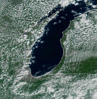
Here’s a satellite picture from Monday afternoon. From Benzie Co. to Indiana, you can see it was clear right by Lake Michigan and partly cloudy in inland areas, where it was a few degrees warmer and differential heating produced rising columns of air the developed the cumulus clouds.
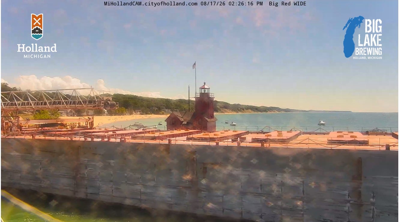
Around 2:30 pm, this mighty ship came through the Grand Haven Channel. BTW, note it’s clear above and to the right over the lake...and you can see the clouds to the left over the land.
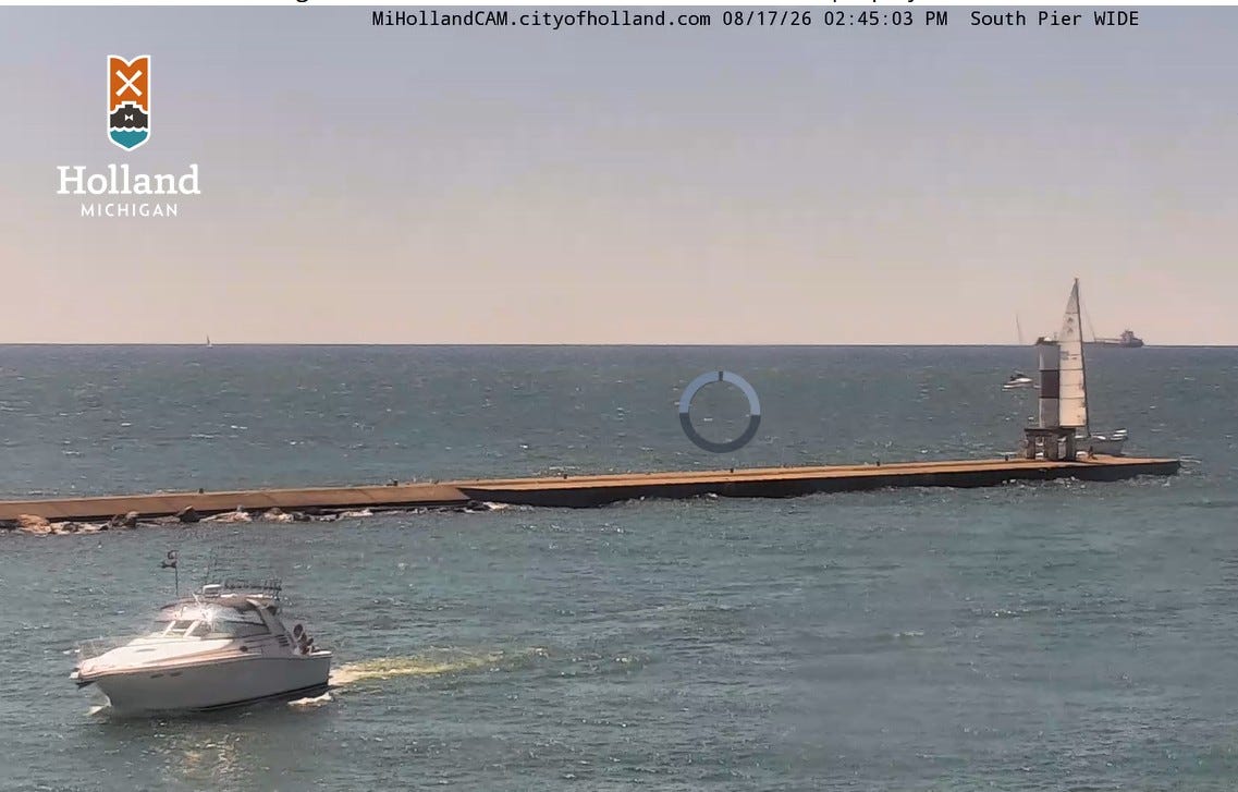
This pic. taken about 20 minutes later shows the ship in the distance by the sailboat heading south. Thanks to the city of Holland for letting me repost pics. from their webcams.