
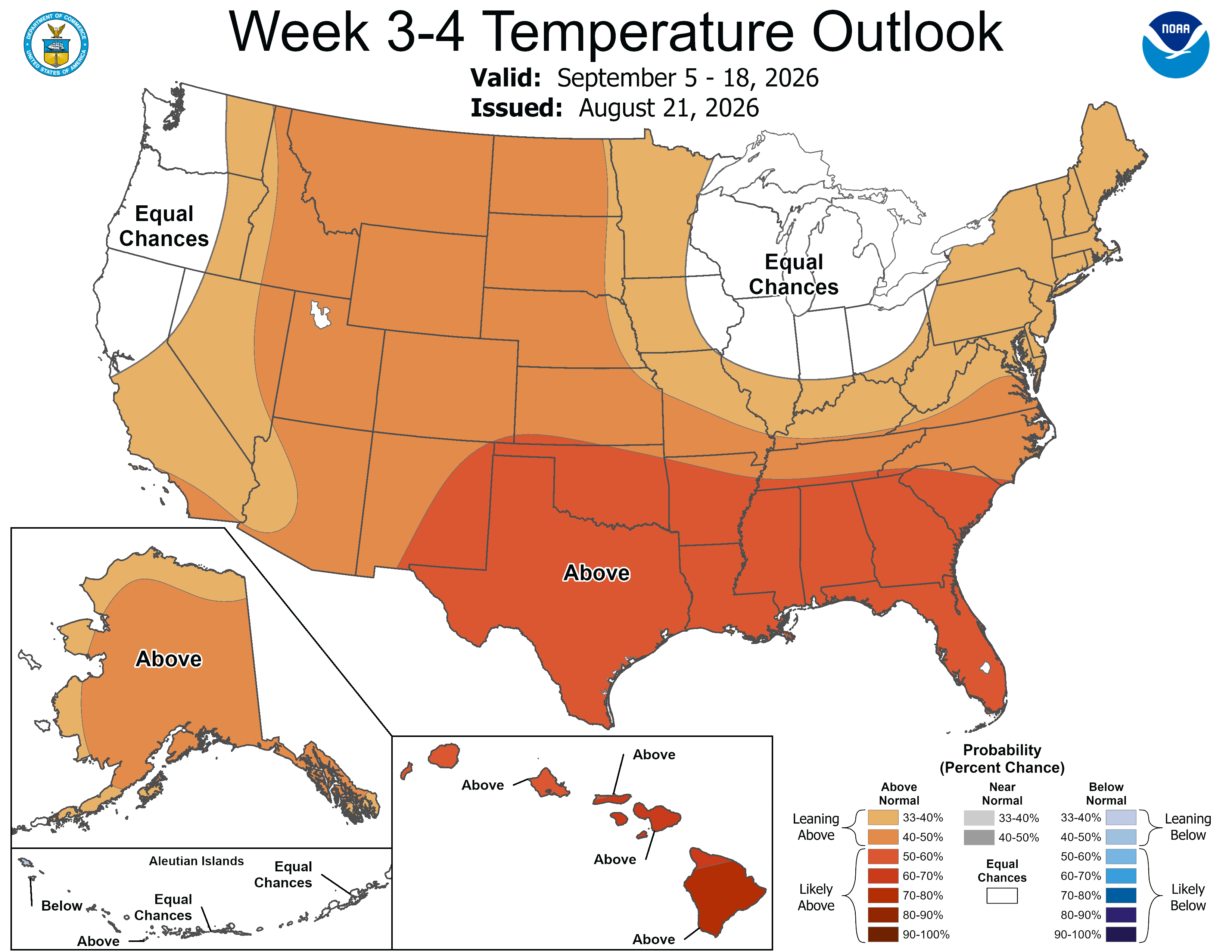
Each Friday afternoon, the Climate Prediction Center issues a long-range forecast for weeks 3 to 4. So, the latest one is out today (Aug. 21) and covers the period from September 5 - 18.
In the western Great Lakes, we have an equal chance of above or below average temperatures. Most of the country is expected to have warmer than average temperatures, not surprising given the strong El Nino pattern we have right now.
This implies a ridge in the Rocky Mountains and a downstream weak trough over the western Great Lakes.
In September, the average high temperature for Grand Rapids is 74° and the average low temperature is 53°.
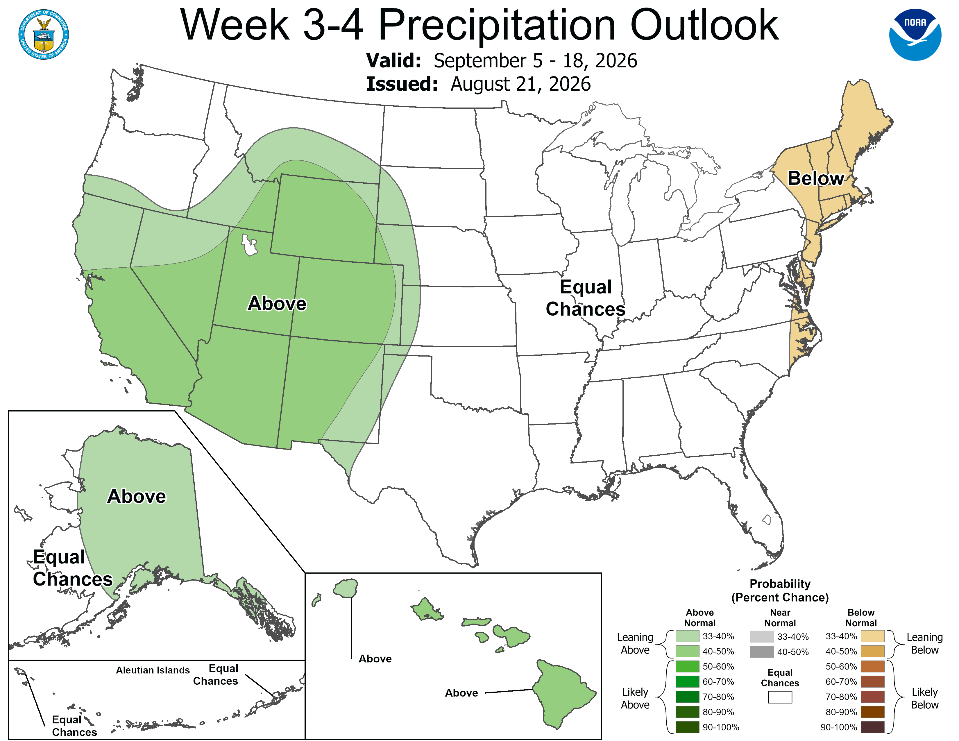
The week 3 - 4 rainfall outlook calls for an equal chance of above or below average. I’d probably side with the slightly below average forecast.
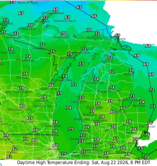
High Temperatures today (Sat.) will be mostly in the upper 70s in inland areas and low-mid 70s at Lake Michigan. Skies most of the time will be partly cloudy and winds will pick up from the northwest at 10-15 or 10-20 mph. So, it may be a touch on the breezy side, especially near the lake in the PM.
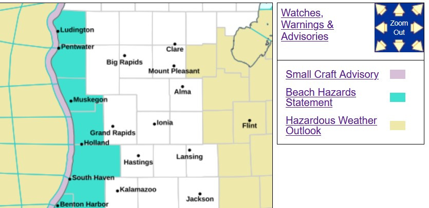
There’s a Beach Hazards Statement and Small Craft Advisories for the lakeshore. Winds should pick up from the northwest at 10-20 knots today and 15-25 knots tomorrow. A knot is roughly 1.15 mph. The Beach Hazards statement runs to Manistee on the north and around the lake to Porter Co. Indiana on the south
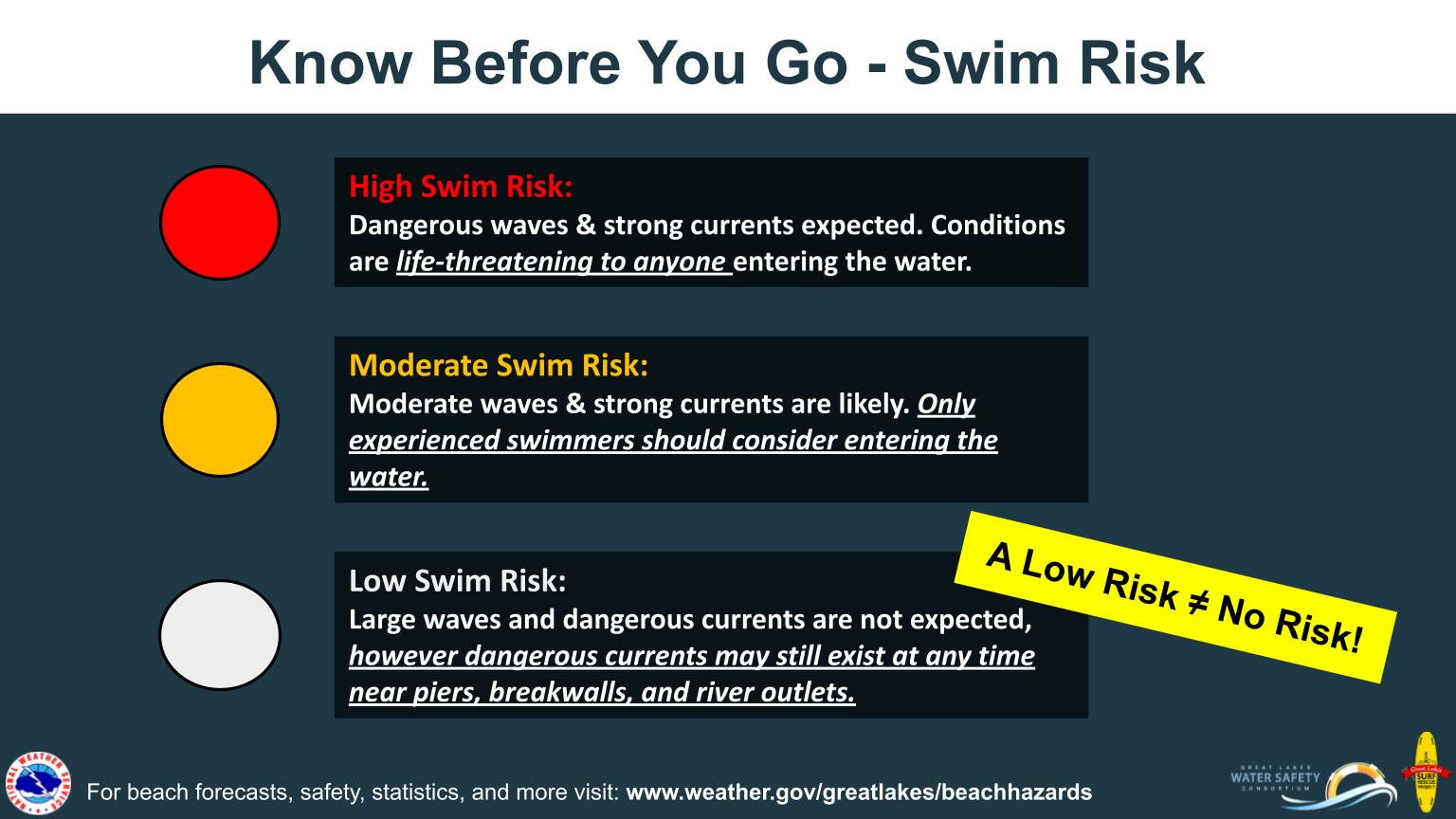
Keep in mind that the flag color at the beaches may change during the day. A green flag in the relatively calm early morning can change to red as winds pick up during the midday.
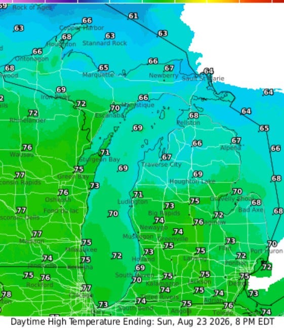
Here’s high temperatures for Sunday…low-mid 70s inland and near 70 at the lakeshore. Temperatures may hold in the mid-upper 60s in northern Lower Michigan and in Upper Michigan.
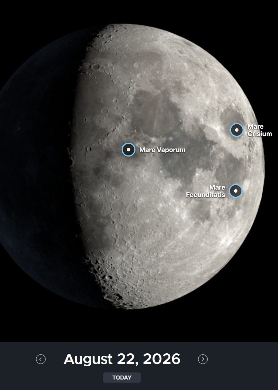
We’re up to about a 3/4 moon that will be out in the evening. Venus is the bright star to the west at sunset.
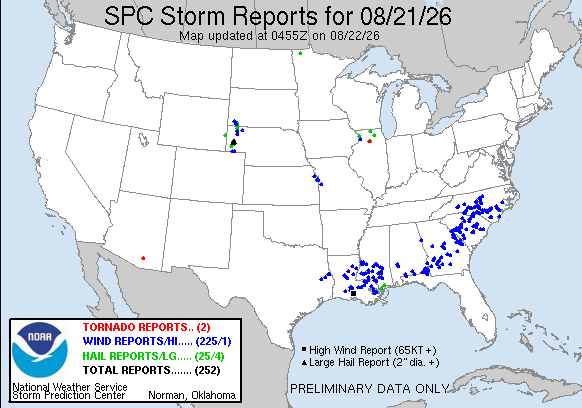
Here’s storm reports from Friday. There were two mall, rather insignificant tornadoes, one in Arizona and one southwest of Chicago at the town of Sublette. Most of the wind damage were in the Southeast from east Taxas to North Carolina. Check out the continuous lightning in Tampa FL. Continuous fast-motion lightning.
As of Saturday AM (8/22), we still have over 29,000 customers without power in Lake Co. Indiana, 11 days after the derecho.
And there are 10,531 customers without power in Hawaii after Hurricane Lala. 9,084 of those customers are on the Big Island of Hawaii.
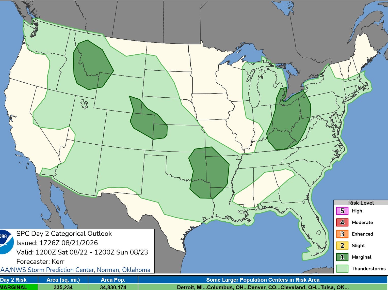
There is a small chance of a non-severe thunderstorm in West Michigan today, but most areas probably won’t see that. There is a Marginal or level 1 risk in Southeast Michigan over by Detroit, but the better chance will be down in Ohio.
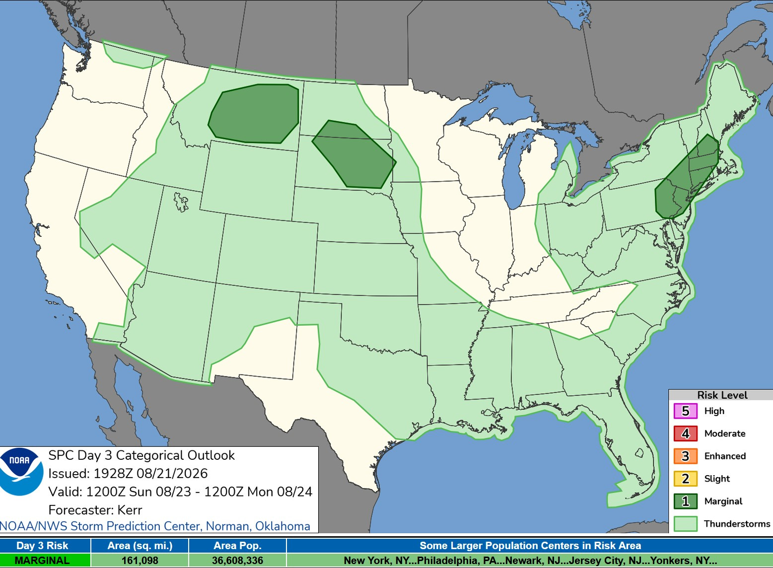
We should stay dry on Sunday with just a slight chance of a non-severe storm in Southeast Michigan Sunday PM.
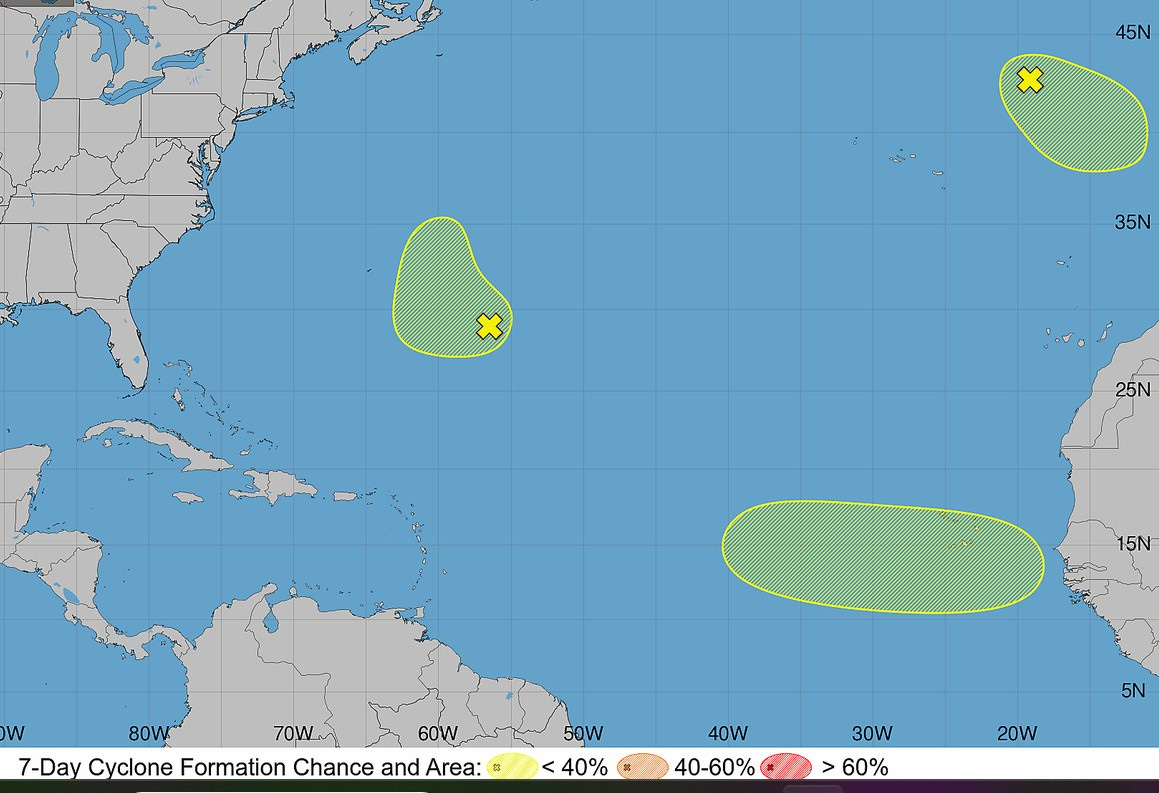
This is the tropical storm/hurricane forecast from the National Hurricane Center. The yellow area west of Africa is the one most likely to develop into a tropical storm and move west. It would stand a good chance of turning north before being a significant to the U.S., but it bears watching. I don’t think anything comes of the other two shaded areas.
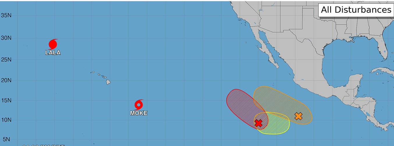
The eastern Pacific sector remains active. Hurricane Lala, the one that hit Hawaii, is moving north toward cooler waters, where it will fade away. We now have tropical storm Moke. That’s headed in the general direction of Hawaii, though it is expected to be slightly weaker and take a slightly more southerly route. Hawaii will get some rain and a couple of windy days, but outside of some local flooding on the windward side of the mountains, Moke will have as an impact like Lala. There is another storm forming to the east (red X) but it should stay east of Hawaii and west of Mexico
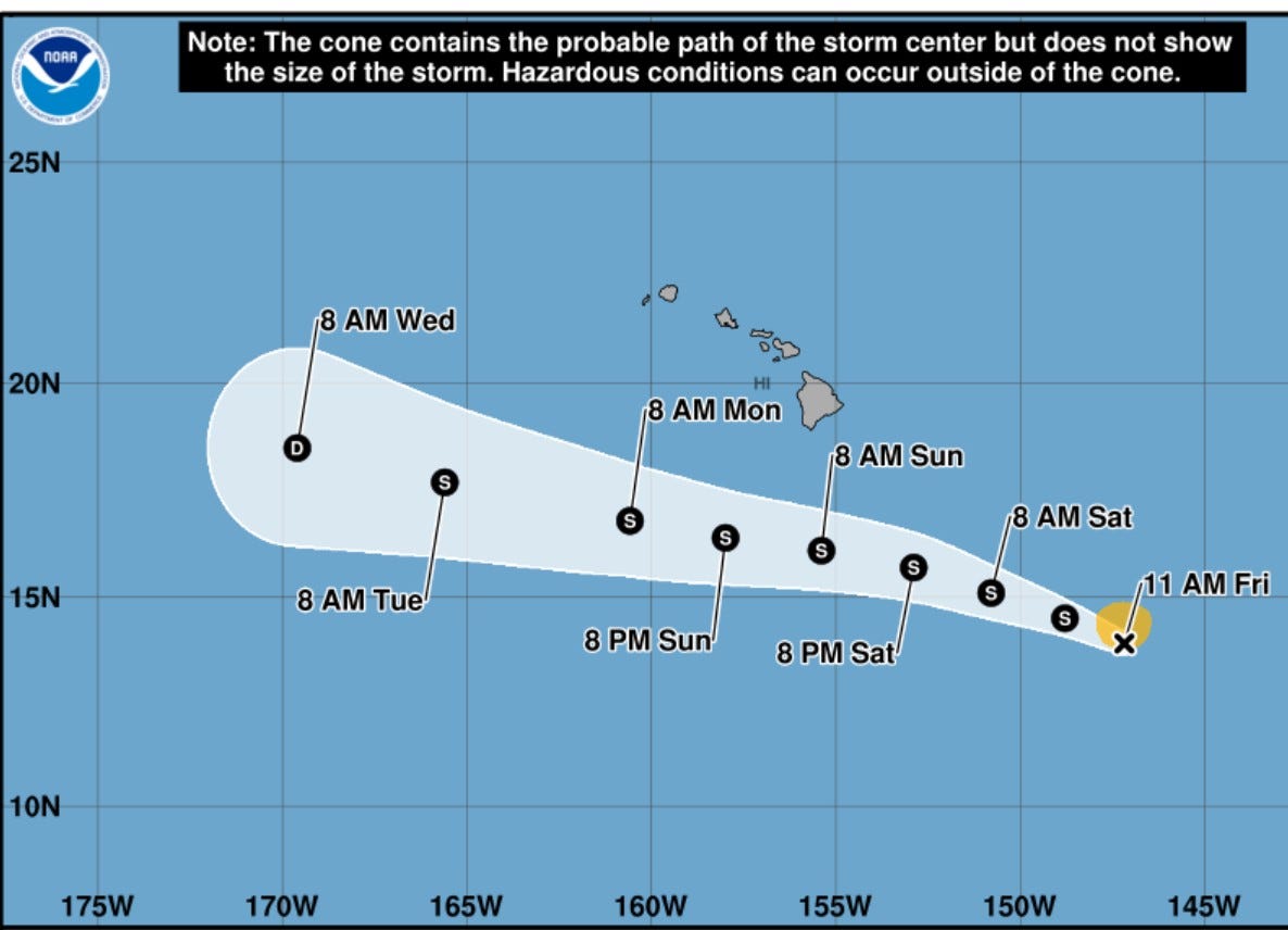
Here’s the forecast path of Moke. The hurricane center keeps the storm at Tropical Storm status.
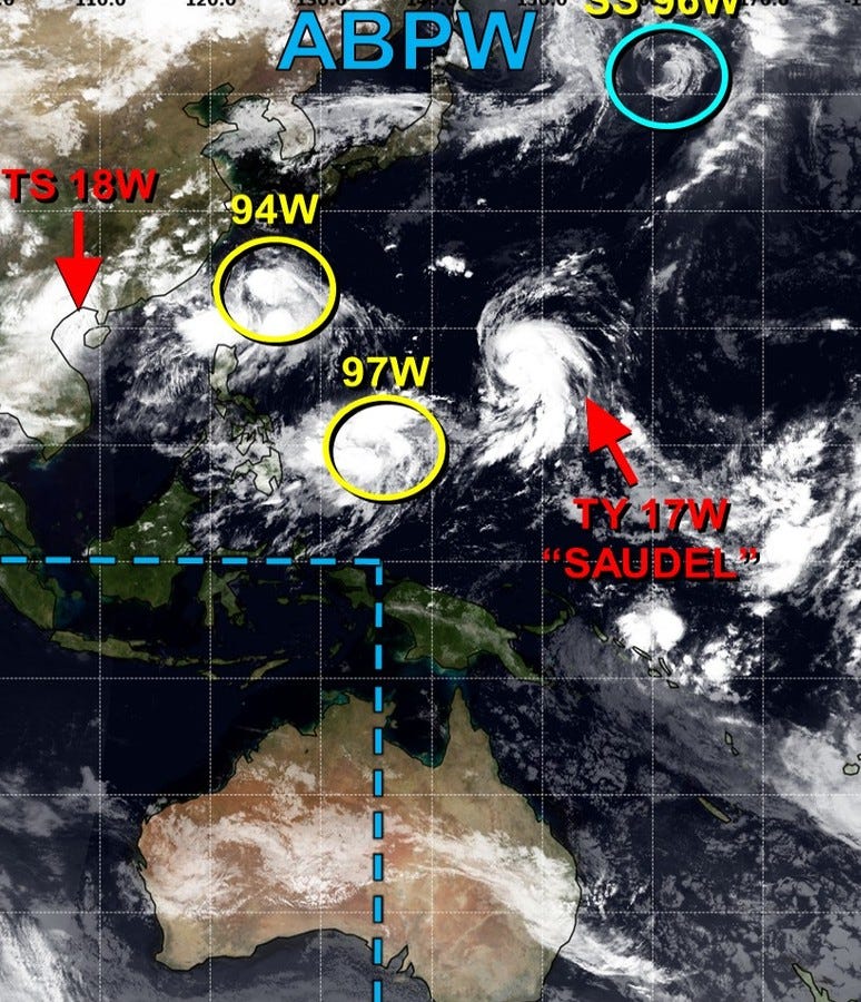
The western Pacific is also rather active. We continue to monitor Typhoon Saudel.
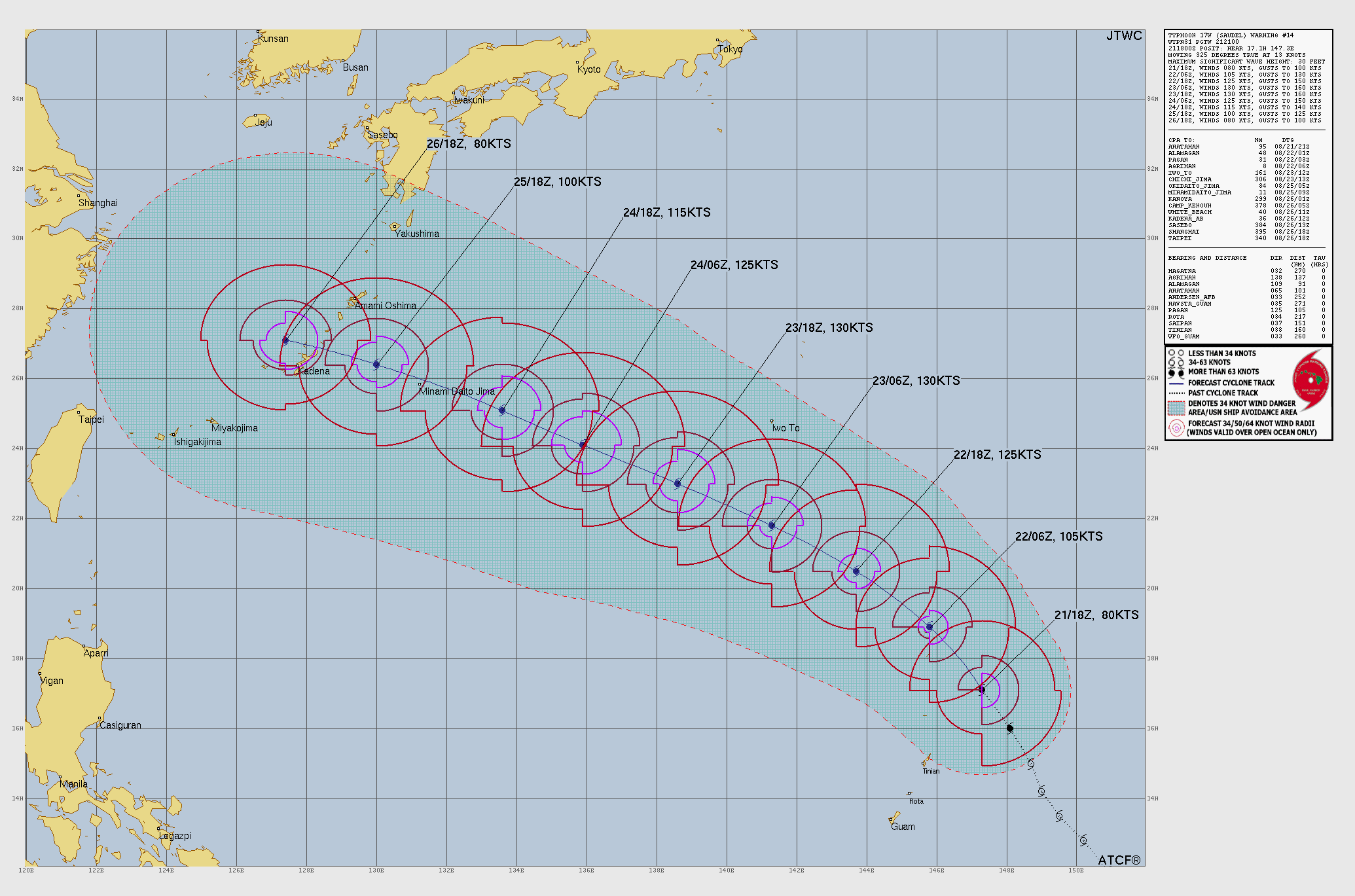
Saudel looks like it’ll go south of Japan, north of Taiwan and into Mainland China near or just south of Shanghai.
Hope you have a happy weekend. Thanks for reading my weather updates,
Thanks Bill for this information.