Slightly Cooler
Continuing Chance of a Thunderstorm

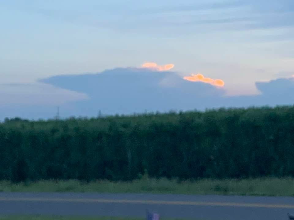
I took this pic. from my house in Alpine Township looking southwest around sunset. This is a thunderstorm that built up over Lake Michigan and brought strong winds and heavy rain to parts of Van Buren, Allegan, Barry and Eaton Counties. Note the characteristic anvil shape of the cumulonimbus cloud.
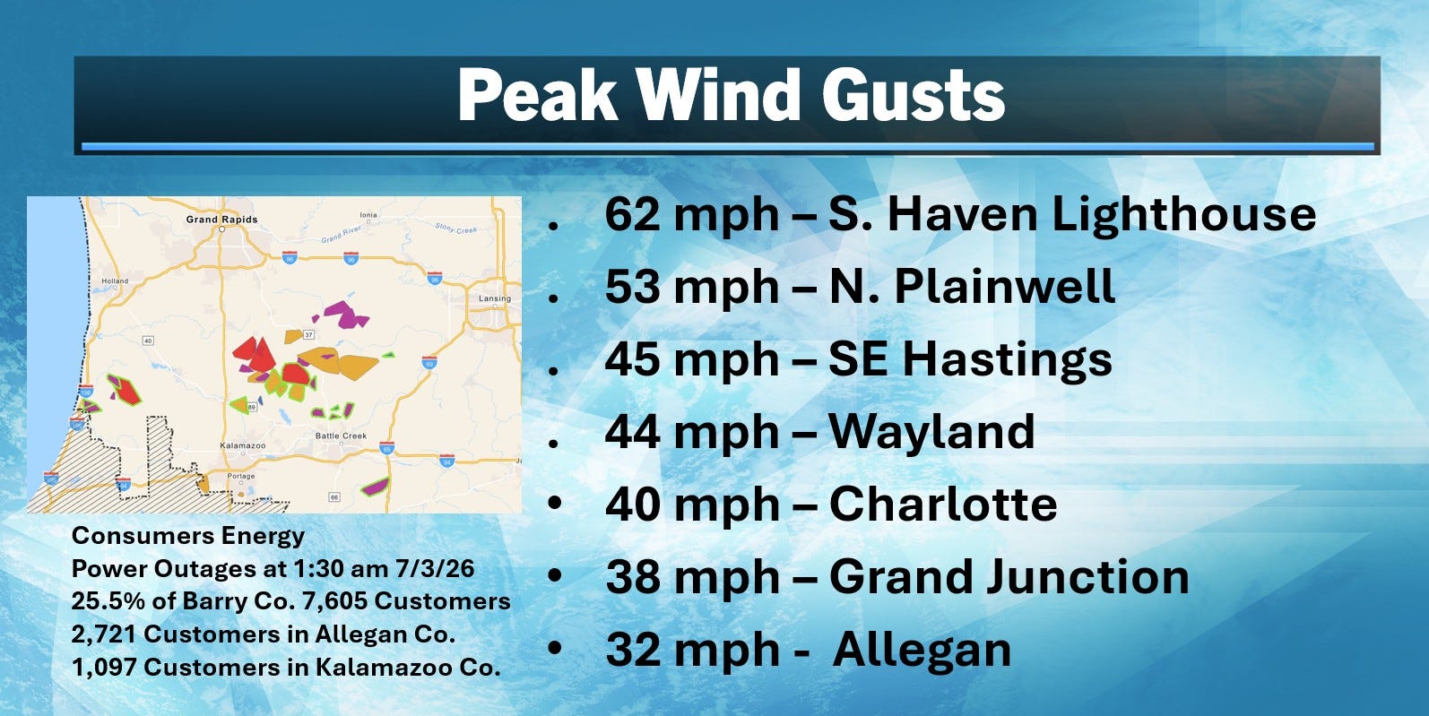
Here’s a look at some peak wind gusts and the Consumers Energy outage map as of 1:30 pm. The South Haven Lighthouse had a gust to 62 mph. I would suspect that parts of Barry Co. (Gun Lake, Gull Lake perhaps) had +50 mph gusts.
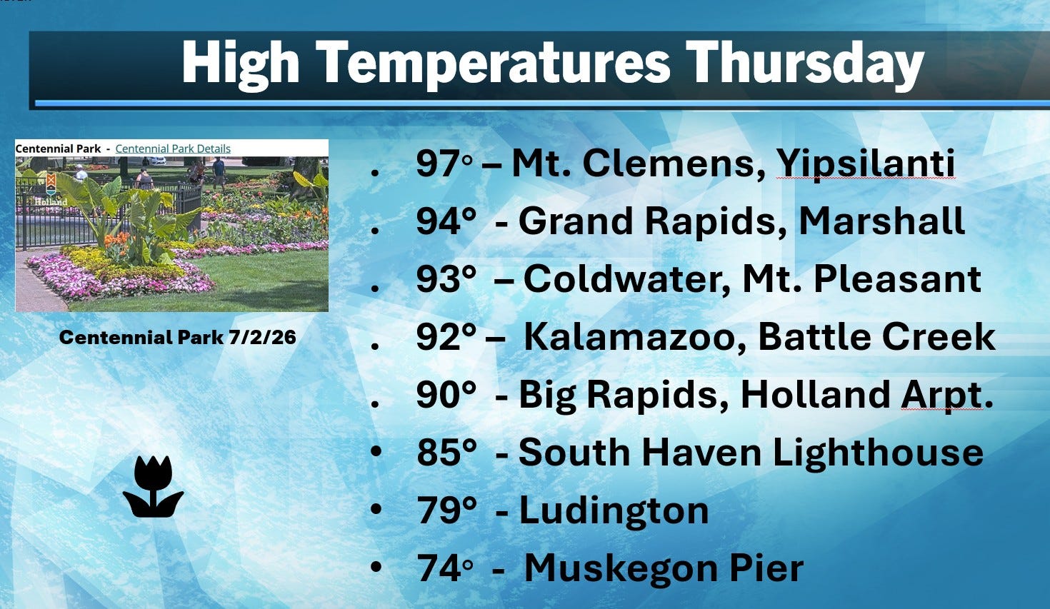
Here’s high temperatures from Thursday. Technically, a heat wave in Michigan is 3 consecutive high temperatures of 90 or better. We’ve now had 4 days in a row of 90 degree heat in most inland areas. Note the cooling affect of Lake Michigan. The high was 94 in Grand Rapids and 74 at the Muskegon pier. The air spends less time over Lake Michigan to get to South Haven, so the South Haven Beach was 11 warmer than the Muskegon Beach.
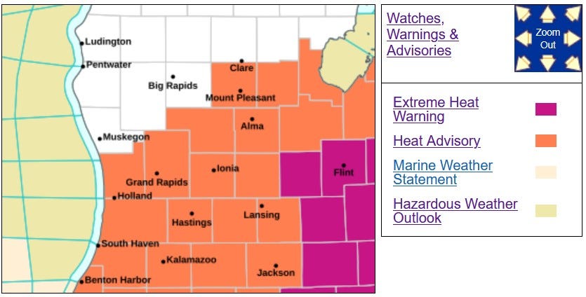
Instead of the Extreme Heat Warning, much of West Michigan has been downgraded to a Heat Advisory for this Friday. It’s still an Extreme Heat Warning for southeast Michigan and the heat headlines have been canceled from Muskegon, Newaygo and Mecosta counties to the north.
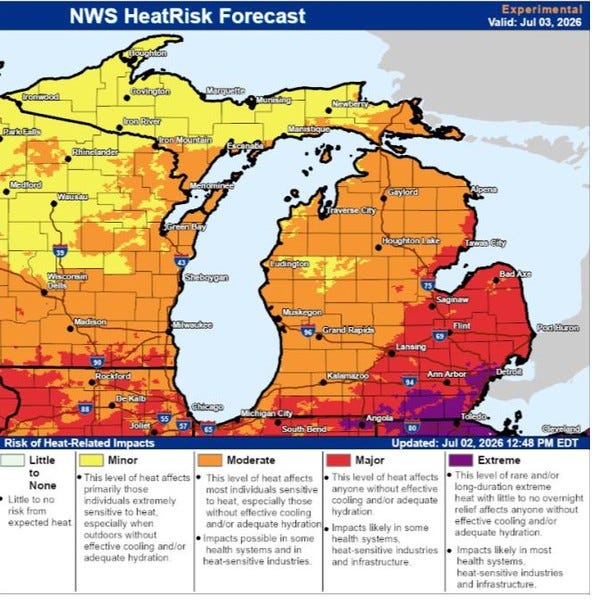
On the map above, the purple-colored area in SE Michigan should reach the mid 90s with a heat index of 100 or better. The red areas are still quite hot. The orange areas are highs around 90 and the yellow areas reach the mid-upper 80s. The map doesn’t show it, but it will be cooler near Lake Michigan.
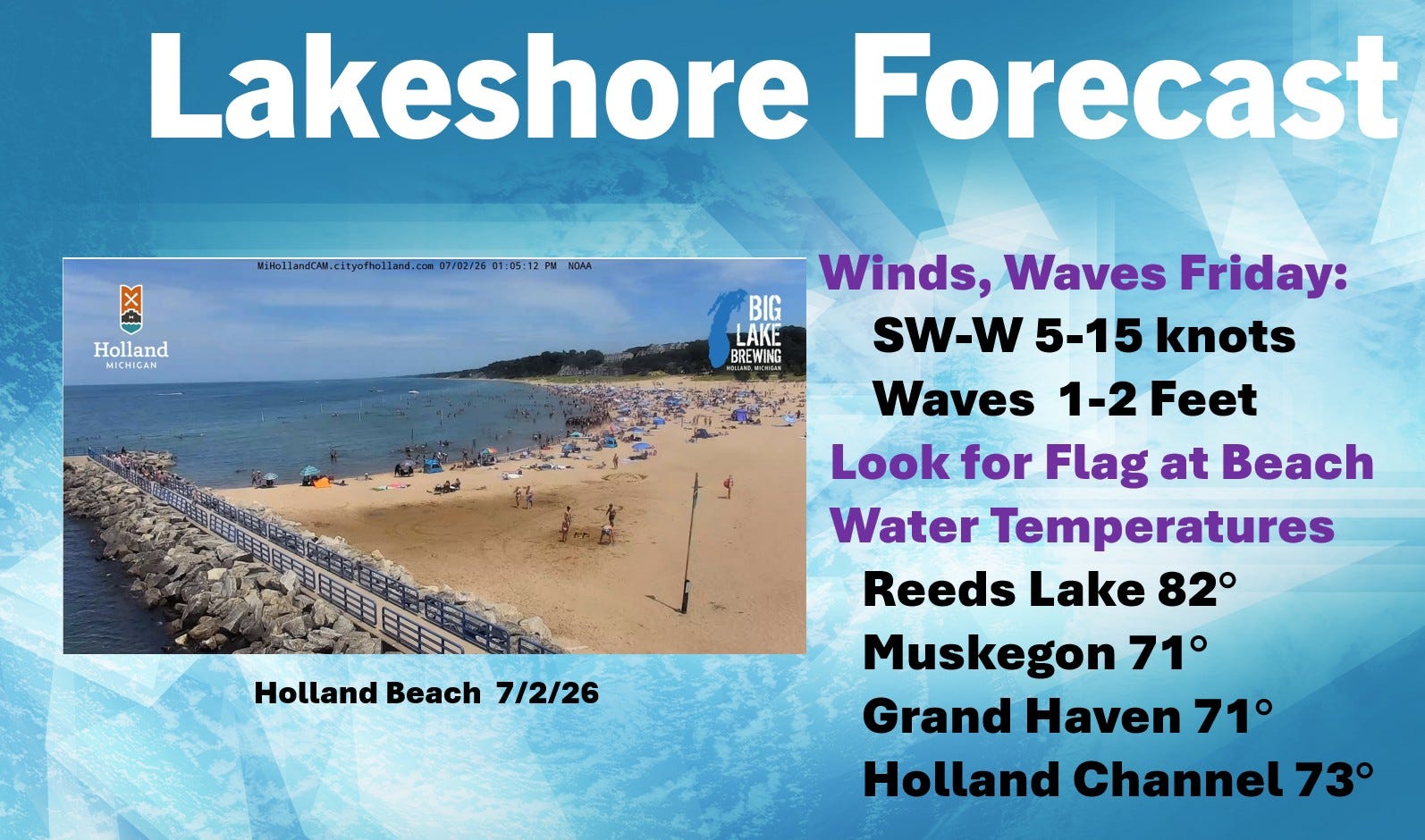
The lakes are warming up. Water temperatures of Lake Michigan Thursday AM were in the low 70s and (inland) Reeds Lake had a surface temperature of 82 for a while Thursday afternoon. Today winds will be southwest to west at 5-15 mph with waves a foot or two.
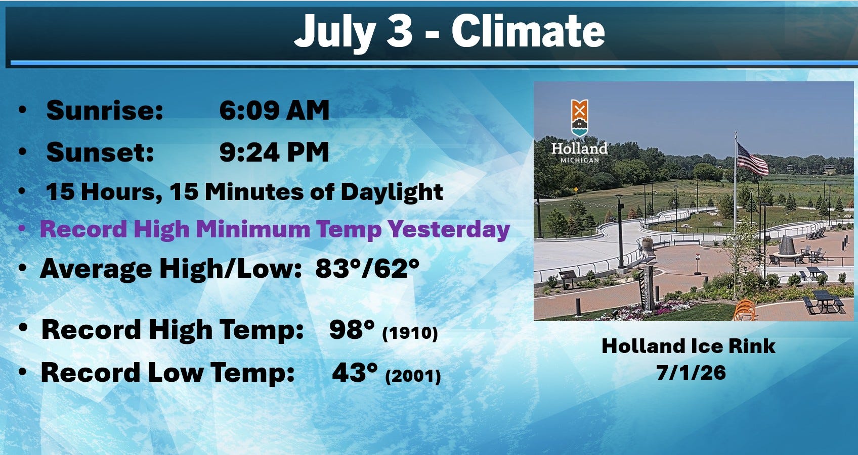
We’ve lost 6 minutes of daylight since the Summer Solstice back on June 21. We had a record highest low temperature for July 2 yesterday. We didn’t get below 78 at night. Today’s record high temperature is 98 and we won’t get that warm.
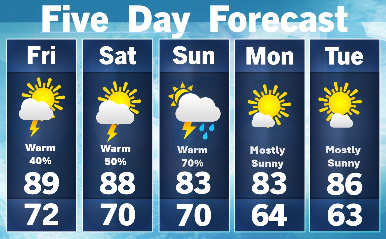
We should be close to 90 in inland areas this and upper 70s to near 80 at the Lake Michigan beaches. While we have a chance of a thunderstorm, an all day rain is unlikely. The chance of rain on the 4th is about 50/50.
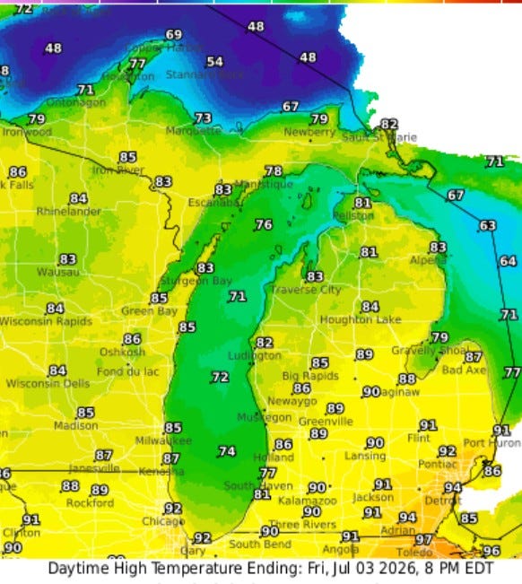
Here’s today’s high temperatures across Michigan. We’re still close to 90 in inland areas of southern Lower Michigan. South Haven (beach) has a more comfortable 77.
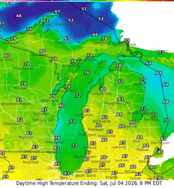
Here’s Saturday’s high temps. Mid 80s in southern Lower Michigan, upper 70s to near 80 in northern Lower Michigan and 60s along the Lake Michigan shore.
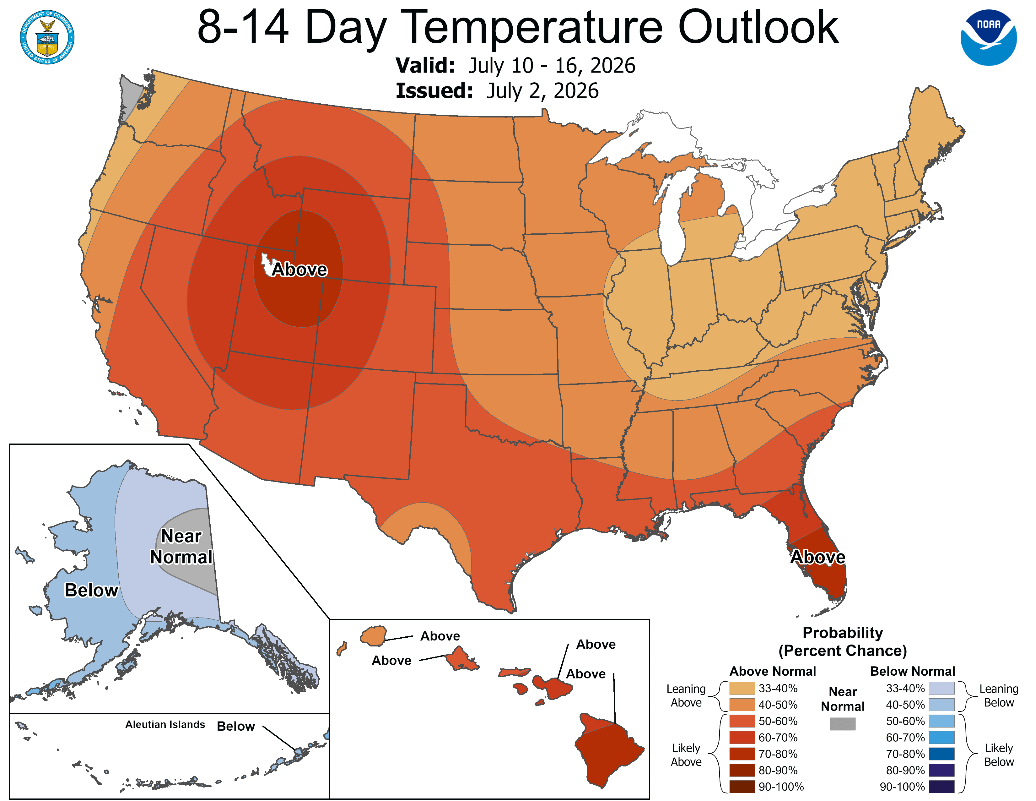
I don’t see any real cool weather in the firsts half of July, though the heat will concentrate in the West and South and temperatures will be back to around the mid 80s for the period in the Great Lakes. Once again, the cool trough is over Alaska.
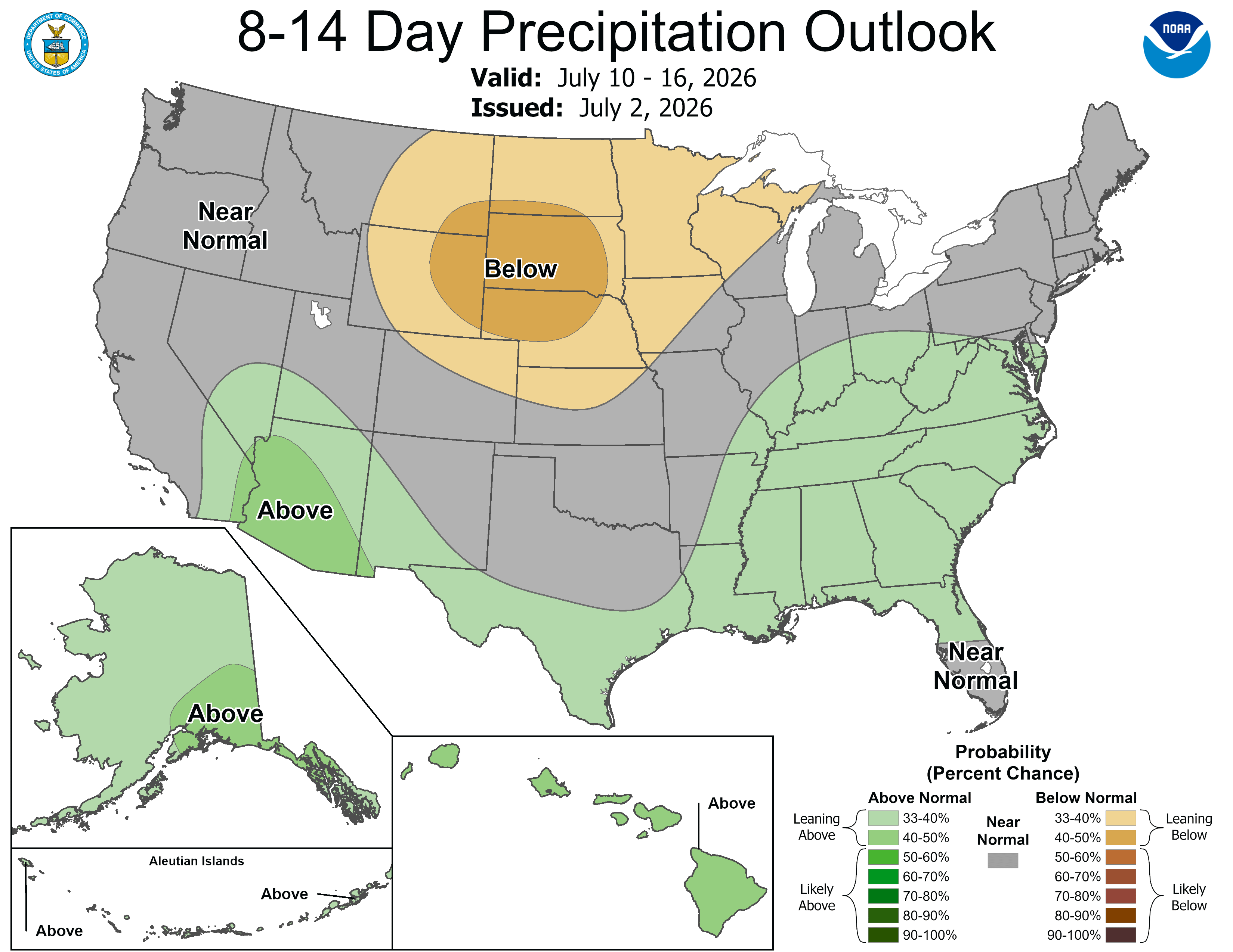
The “monsoon” is on in Arizona with a few widely scattered thunderstorms. Scattered storms in the South up to the Ohio Valley and generally dry weather for July 10-16 in the Upper Midwest.
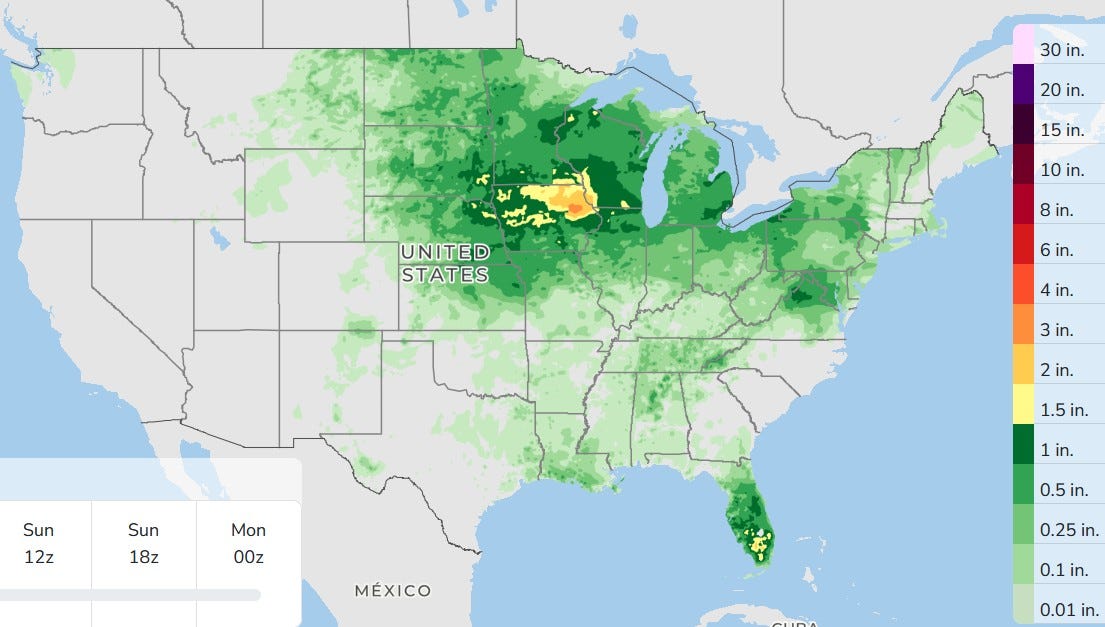
Here’s 3 day total rainfall. The West is generally dry. Showers and storms are likely in the Florida Peninsula. The heaviest rain will be in the upper Mississippi River Valley.
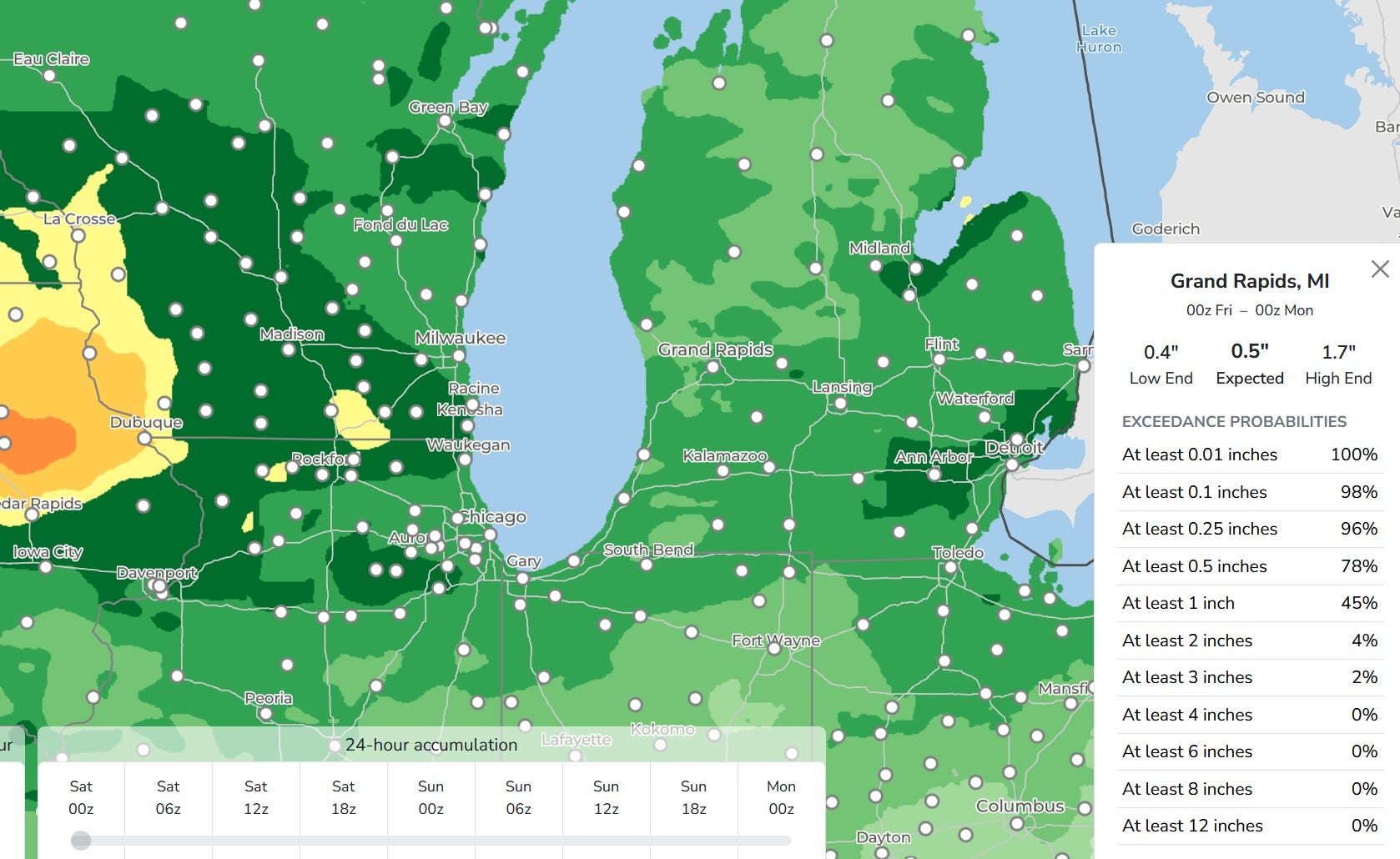
Here’s a close-up view of WI/MI. Grand Rapids gets an average of around 1/2”. Everyone gets some rain. The heaviest rain is in Iowa and Wisconsin.
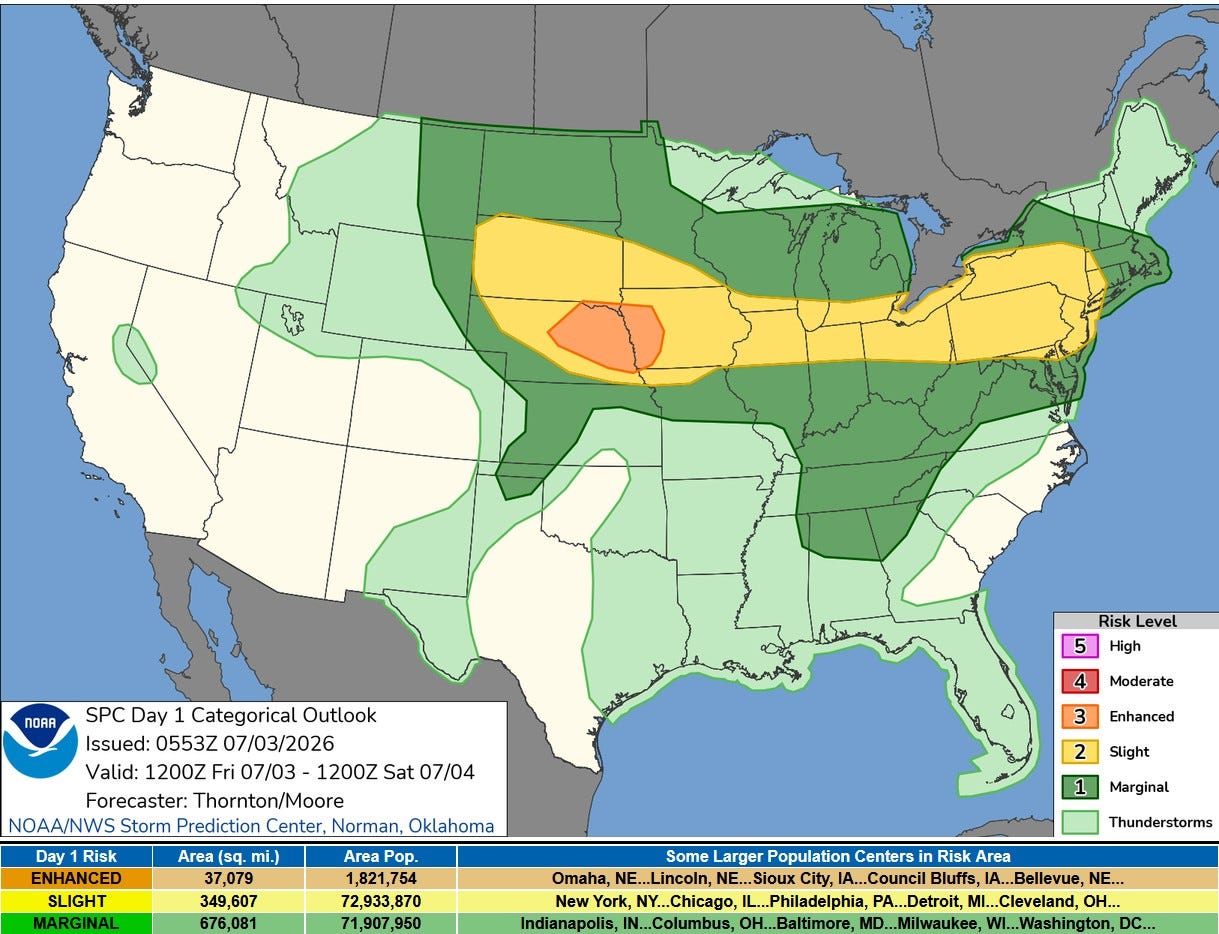
Here’s the severe weather outlook map for this Friday. There’s an Enhanced level 3 outlook for eastern Nebraska and western Iowa and there’s a long level 2 Slight Risk from South Dakota to the Atlantic Ocean. The level 2 risk includes areas along and south of I-94.
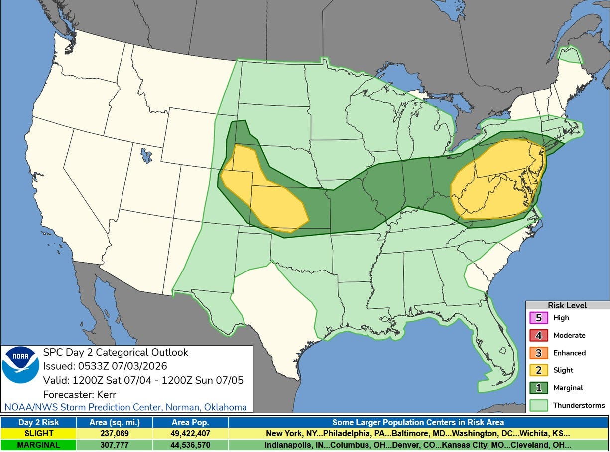
On Saturday Michigan is in the light green General Thunderstorm Outlook (not severe). The Marginal Risk (level 1) covers most of Illinois and Indiana. There are level 2 Slighr Risk areas in the Central High Plains and mid-Atlantic areas.
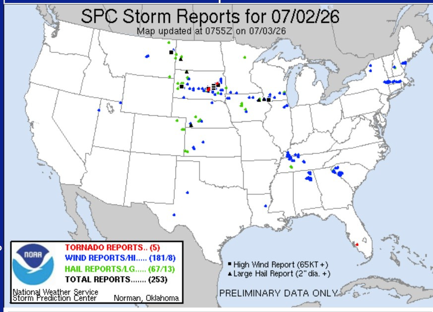
As of 4:10 am Friday, we had 253 severe weather reports. There were 5 tornadoes, 4 of them in South Dakota. There was no real significant damage or injuries that I saw. A gust to 105 mph was recorded at the Huron SD airport, while Alpena SD reached 90 mph. Hail to 3 1/2 inches in diameter fell at Maynard SD.
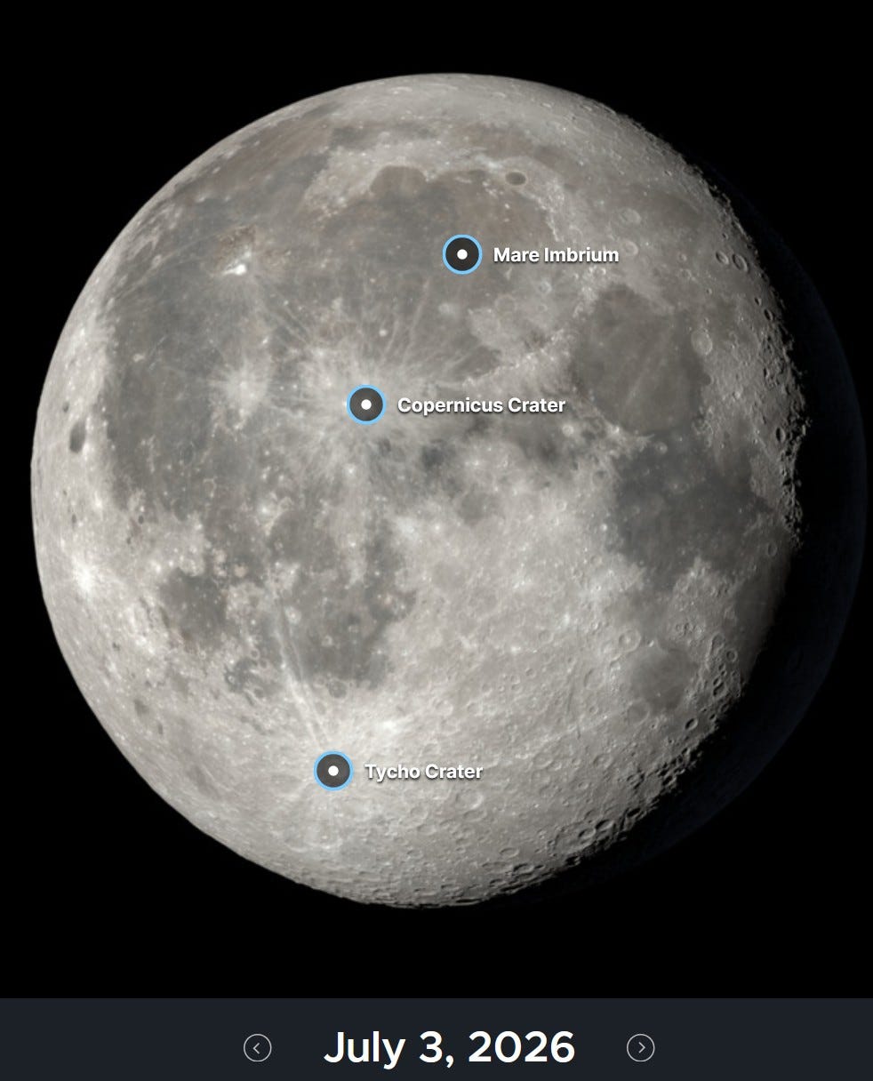
This is what the moon looks like today. It’s still about 89% full. Venus is still shining brightly to the west after sunset. My wife and I have had fun seeing who’s the first one to spot Venus, usually right about sunset if you know where to look.

You’ve probably heard of the “dog days of summer” - warm days when dogs are rather lethargic. Well, in our house we have the “cat days of summer”. Here’s “Joy” and Noname (pronouced “no-nom-me”. We have a third cat, “Eli-Lou” after our mothers, Elinor and Louise.
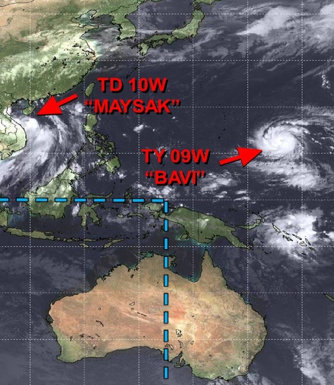
In the Western Pacific we have Tropical Depression Maysak, which will cross Hainan and head into southern China with locally heavy rain and maybe some local flooding. Typhoon “Bavi” has rapidly intensified and this will be a major hurricane. By the way, look at how sunny it is in Australia, hardly a cloud in the whole continent.
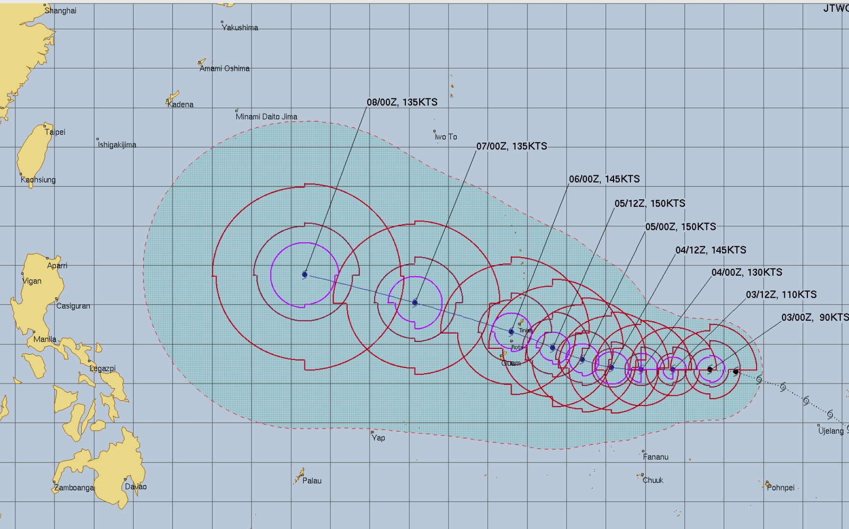
Bavi will be a very significant hurricane for Guam…then it heads west-northwest toward Taiwan.
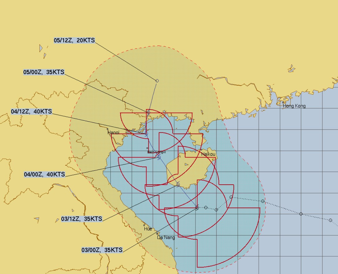
Maysak will either be depression before it reaches the China coast.
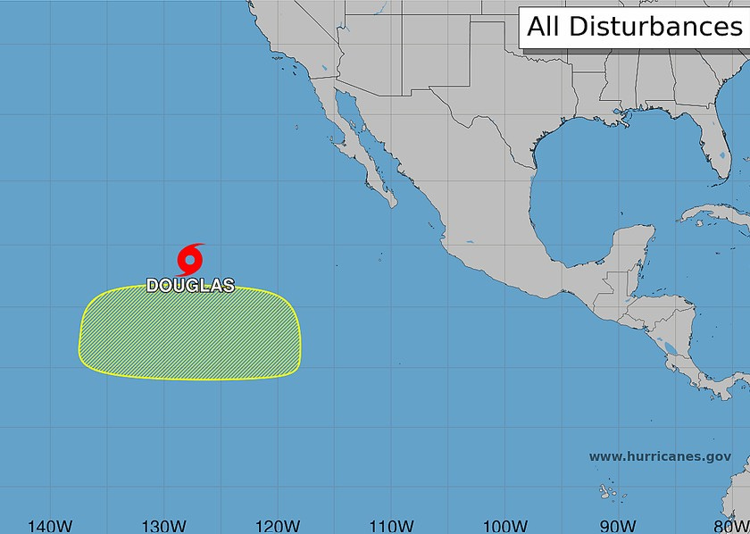
Douglas is a bare minimum tropical storm and should weaken to a depression later today. It’s drifting north and no threat to land.
ALSO: Volcano in eastern Russia. Volcano in Indonesia. Flooding in Italy. Snow in Australia. Flooding in Mexico. Flooding in China. Wildfire in Colorado. Debris. Waterspout in Germany.